Project Overview
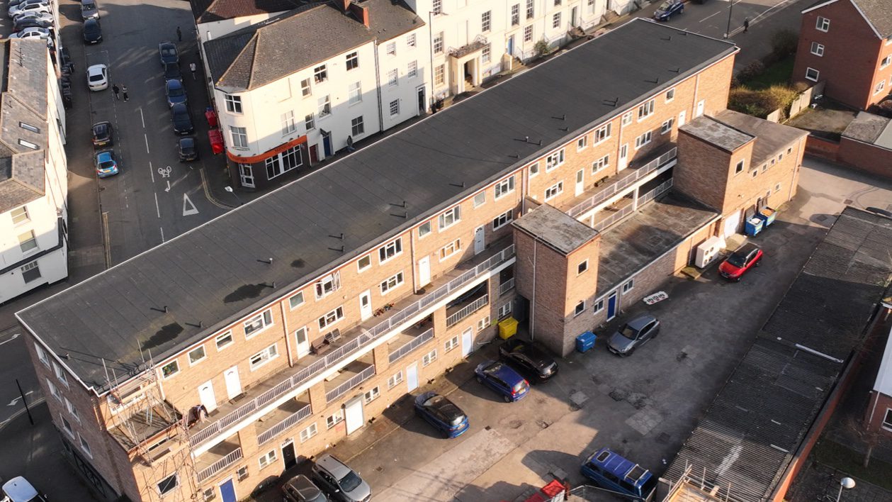
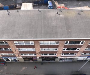
Survey Air was appointed to undertake a 3D UAV mapping survey of a four-storey mixed-use terrace on Brunswick Street, Leamington Spa CV31 2DT. The objective was to generate an accurate point cloud dataset and extract CAD drawings to support design, planning, and asset documentation.
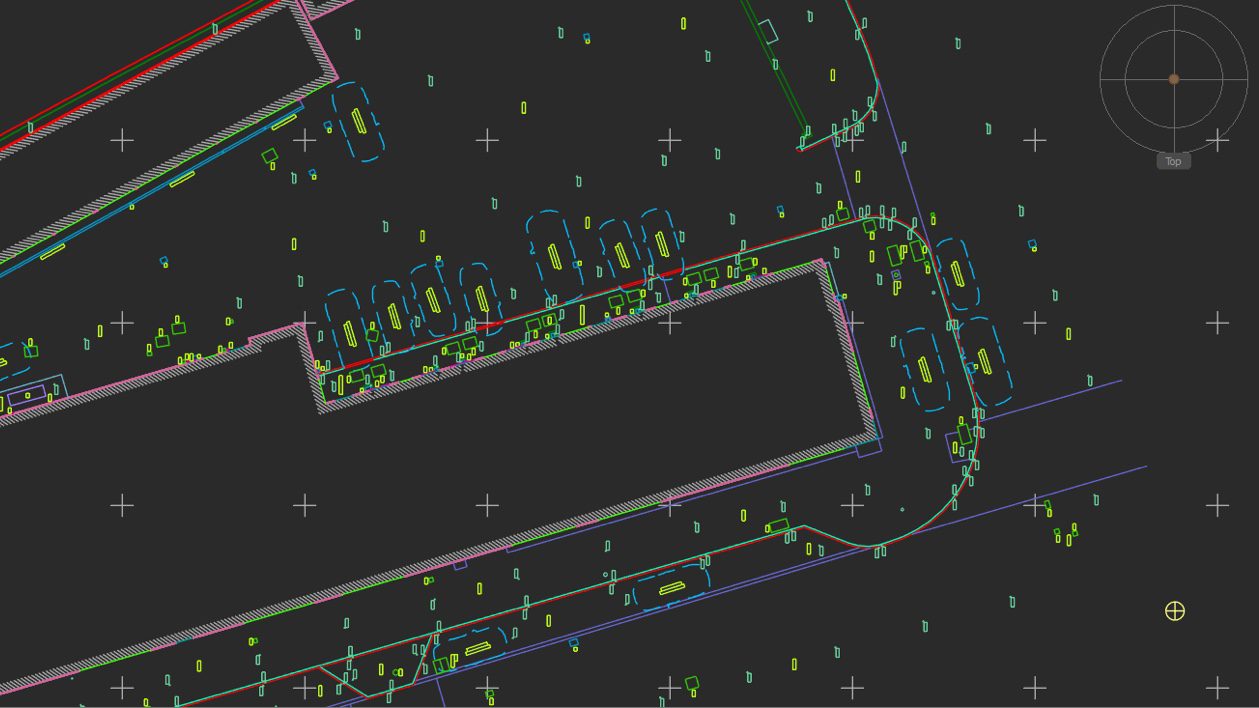
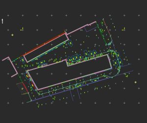
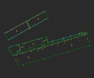
The survey outputs included a detailed Site Plan and Roof Plan at 1:100 and 1:500 scale, delivered in both DWG and PDF formats. The data was produced to integrate directly into professional design workflows, providing architects and consultants with reliable, survey-grade information for downstream use.
Challenge
The site presented typical urban constraints, including restricted access, adjacent buildings, and active commercial frontages. Capturing complete and consistent photogrammetry data across elevations and roof structures required careful flight planning to maintain overlap, coverage, and data quality.
Achieving survey-grade accuracy for CAD extraction also introduced complexity, requiring precise ground control and consistent image acquisition. Ensuring the dataset could be reliably processed into a clean point cloud and translated into usable CAD outputs was critical to meeting client expectations.
Approach
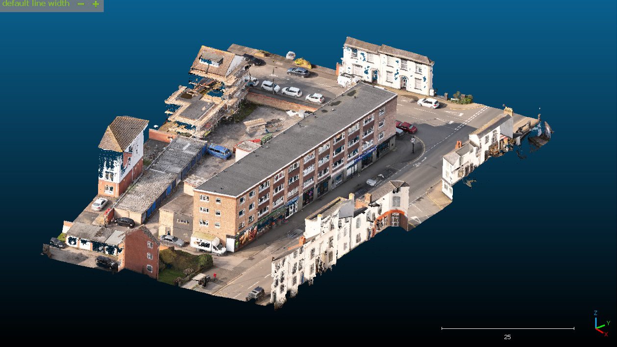
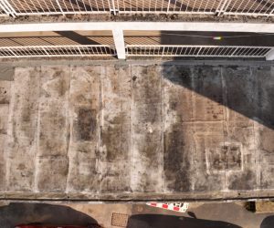
Survey Air deployed automated UAV flight missions, supported by manual capture where required, using a DJI Mavic 3E with a 4/3 CMOS sensor operating at up to 110m altitude. High-resolution RGB imagery was captured with sufficient overlap to enable accurate photogrammetric reconstruction.
Ground Control Points (GCPs) were established around the site perimeter and recorded using a GNSS receiver to ensure absolute positional accuracy. The processed imagery was converted into a dense point cloud and subsequently used to produce scaled CAD drawings aligned with industry-standard design workflows.
Let's Talk
Request a quote for a project
We offer unrivalled pricing, allowing drones to be more cost effective and accessible to our clients. Get in touch for a quote.