001 - Overview
What is a 3D Building Model?
Understanding the terms and appropriate uses is essential for achieving the right outcome for your project.

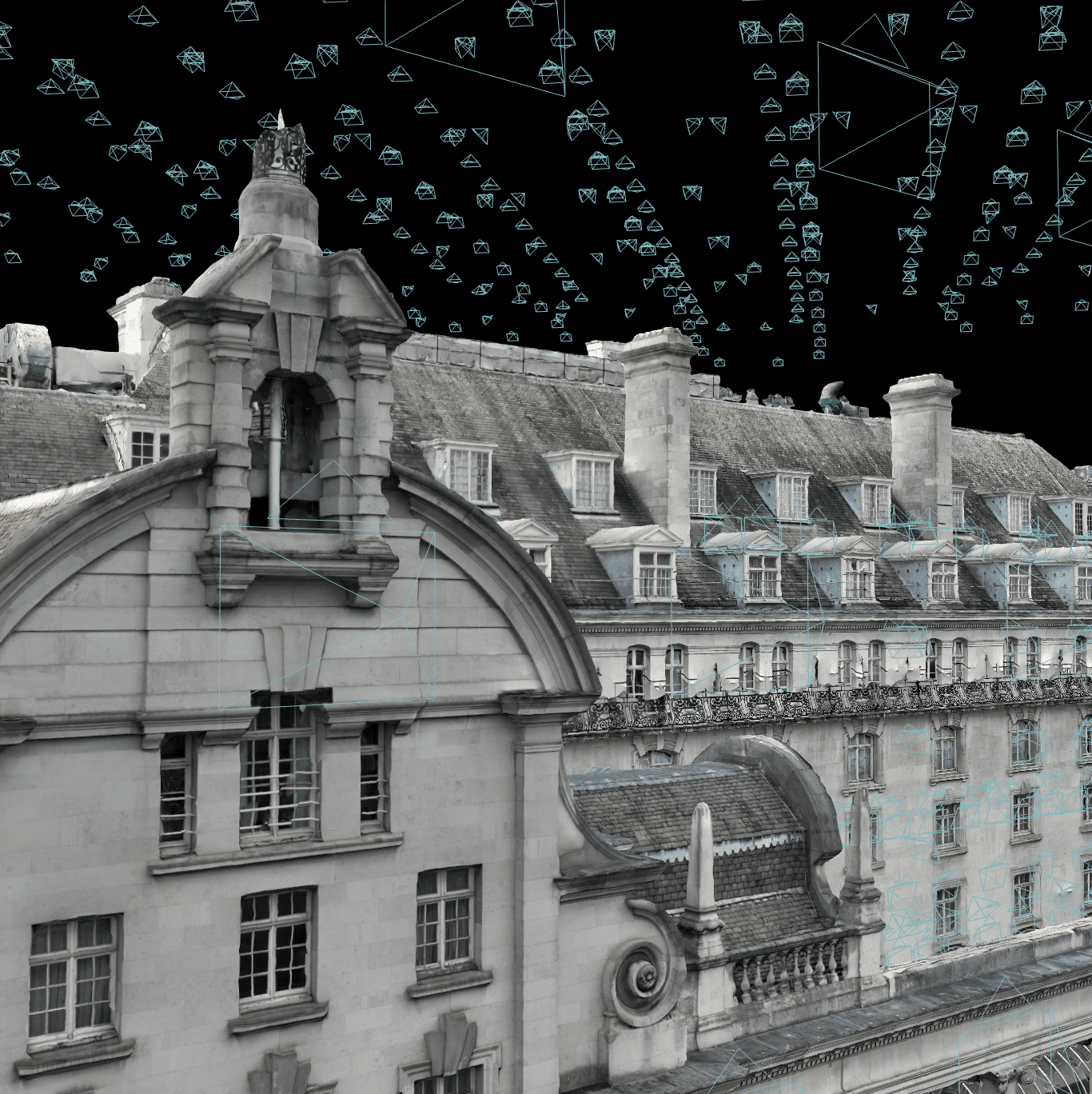
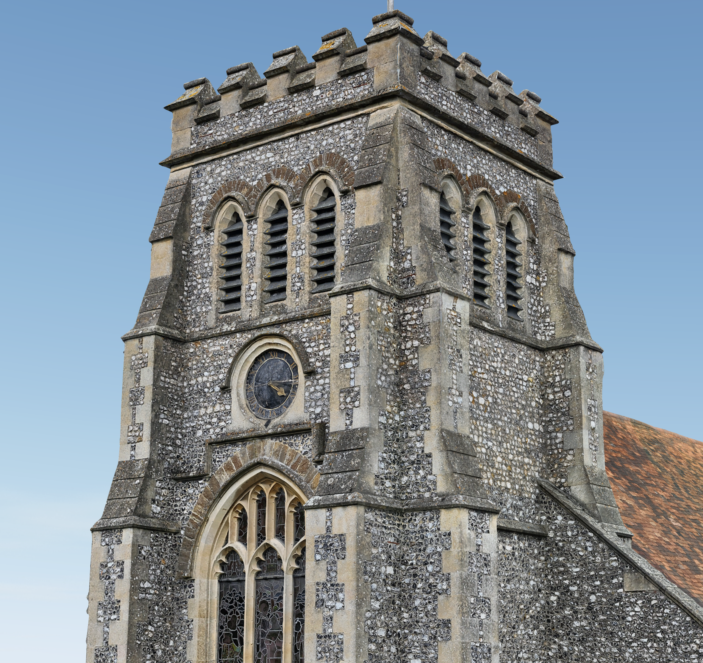
A 3D building model is a general term for an accurate digital representation of a building or structure, often used in architecture, construction and surveying.
What are the differences between 3D Model & Digital Twin?
These terms can sometimes be confused as some practitioners may use them interchangeably, while others see them as distinct. Find out how 3D Models & Digital Twins differ in nature.
3D Model
A 3D model generally refers to a digitally rendered 3D object or landscape, containing static datasets with no real-time digital information, which includes a geo-referenced structural form with photorealistic texture and colourised mesh.
Digital Twin
3D Models form the basis of Digital Twins, however, Digital Twins contain dynamic datasets such as digital assets for use in BIM & CAD models, and connected to supporting data about construction objects and processes.
002 - Advantages
What are the key strengths of 3D Building Models?
Harness the power of technology for superior planning, monitoring, and decision-making in your projects.
What are the main benefits of 3D Building Models?
3D Building Models can represent complex geometries with high fidelity, particularly relevant to building inspection, where defects and issues up to +/- 20mm can be located and understood.
Accurate & Easy Visualisation
3D Building Models can represent intricate surface features with centimeter-level precision, while providing a realistic and immersive visualisation of the structure.
Complex Geospatial Features
3D Building Models can be useful for modeling irregular, complex surfaces, such as the underside of building roof and façade features with more than a 90-degree angle.
Smarter Building Managment
3D Building Models allow for proactive maintenance and optimised resource allocation, while creating a digital record of the building for future maintenance and renovations.

Coming Soon: 3D Building Model Demo
003 - Industry Sectors
How will 3D Building Models benefit my project?
We leverage cutting-edge UAV imaging technologies tailored to meet specific project needs.
Urban Planning & Development
Digital Twins & City Modelling
Aid in planning and visualisation of city infrastructure, used for zoning, urban planning, and assessing the impact of proposed developments.
Sunlight & Shadow Analysis
Assess how buildings and other structures interact with sunlight and shading, used for Right to Light analysis and optimised solar panel placement.
Construction & Refurbishment
Real-Time Monitoring
Closely monitor planned construction works throughout the lifecycle of a project, as frequently as every day, assisting in detailed progress reporting.
Feasibility & Design Collaboration
Facilitate clear communication and clash detection between architects, engineers, and contractors using a shared digital 3D model.
Surveying & Property Maintenance
Proactive Asset Management
Prioritise maintenance needs, schedule renovations, and track changes over time, empowering you to make strategic investments and maximise value.
Targeted Repairs
Identify potential building defects such as damaged roofs or facades, allowing for proactive maintenance and accurate budget cost estimations.
Telecommunications
Signal Propagation Analysis
Plan and optimise the placement of cellular towers and other communication infrastructure for better coverage and performance.
Network Planning
Designing complex telecommunications networks in urban and rural areas, considering the impact of terrain and buildings on signal transmission.
Archaeology & Cultural Heritage
Site Documentation
Creating high-resolution 3D models of archaeological sites, conservation areas and historical landmarks for future preservation and study.
Virtual Reconstruction
Reconstructing historical sites and artefacts in a 3D perspective to help visualise and analyse their original appearance and function.
Environmental Management
Forest Inventory & Management
Analyse forest structure, estimate biomass, and plan sustainable operations to improve water quality, soil health, and carbon sequestration capability.
Flood Modelling
Simulate water flow, including runoff from building and around structures, helping in designing flood defences and planning evacuation routes.
004 - FAQ
Want to find out more?
Everything you need to know about our 3D Building Models.
Yes, our 3D models are created using RTK and GCPs, which allows us to confidently relay how accurate objects and measurements relate to their real-world counterparts, achieving model accuracies of around 2cm or less and effective visual ‘resolution’ of a few millimetres.
There is almost no end to the range of different types of sites and landscapes that can be turned into a 3D model – from individual garden sheds or properties, to entire villages, nature reserves or large-scale construction projects. The only caveat is that sites subject to a lot of change and movement, such as the immediate area of waves arriving at an ocean shore, will not be able to be clearly rendered.
No, while some users may prefer to import 3D Mesh files directly into their own software for further processing, we are able to provide specialised mapping platform allowing our clients to access their model through a simple browser-based viewer, available any time, anywhere and without needing anything more than a standard office PC or laptop with at least an average-speed internet connection.
A 3D building model is the ultimate tool to expedite PPM, allowing cracks and defects of as little as a few mms in size to be precisely-located, viewed, measured and annotated at the click of a button. Quarterly, or annual, UAV survey inspections can vastly improve asset management process, track site changes over time, and prioritise maintenance tasks.
005 - Contact
Have a project to discuss?
Have a project to discuss? Get in touch for a quote.