001 - Overview
What is a Digital Elevation Model?
Understanding the differences and appropriate uses is essential for achieving the right outcome for your project.

Digital Elevation Model (DEM) is an umbrella term for a model which maps the surface of the earth, and are generally recognised in two different forms; DTMs & DSMs.
What are the differences between DEMs, DTMs & DSMs?
Choosing the right data product for your project is essential. DTMs and DSMs provide crucial details for various applications, and offer unique strengths for digital terrain analysis.
Digital Terrain Model (DTM)
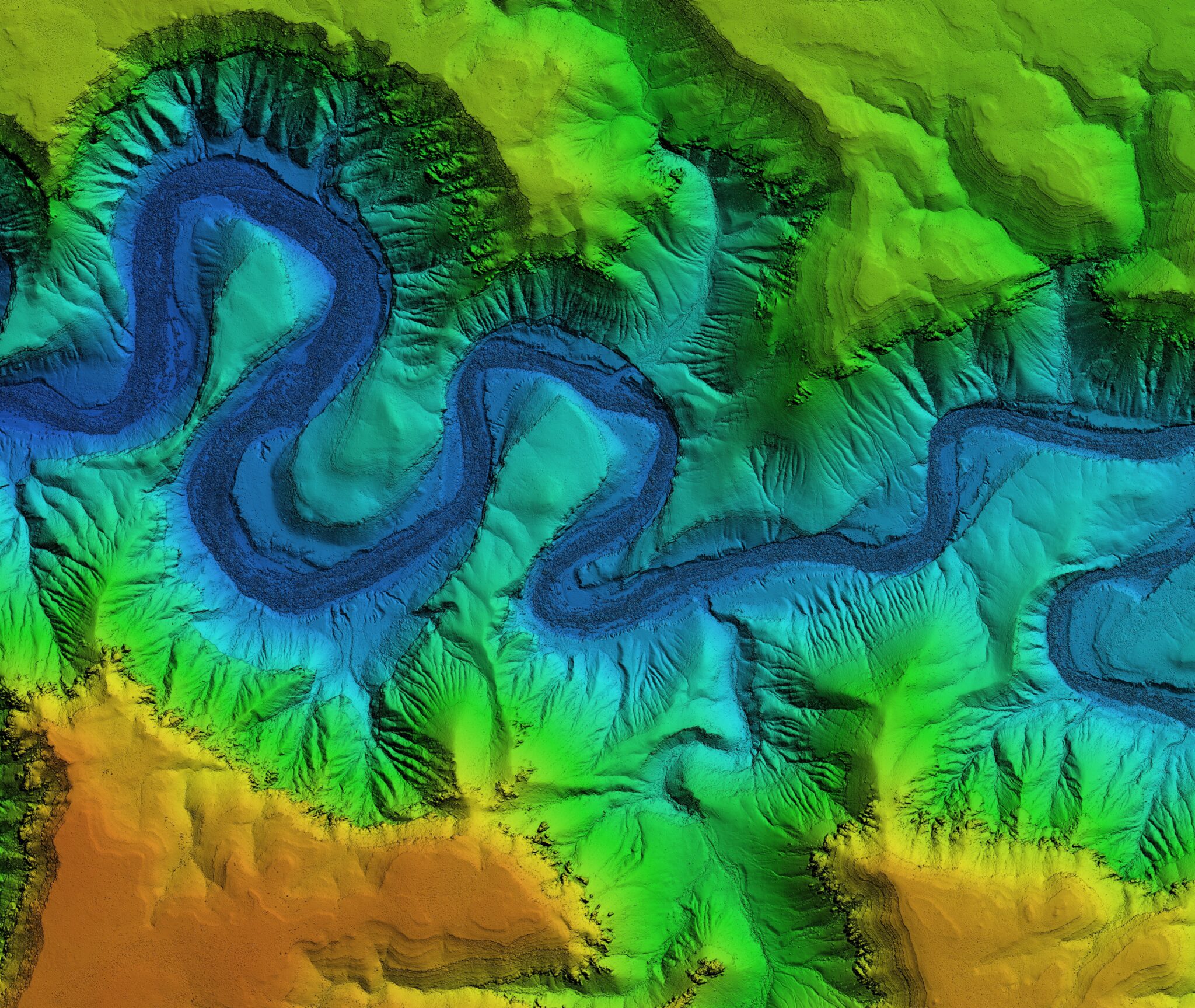
A Digital Terrain Model (DTM) represents the bare Earth's surface, stripped of any natural or man-made objects. It captures the elevation data of the ground itself, including features like hills, valleys, and plains but excludes objects such as trees and buildings.
Digital Surface Model (DSM)
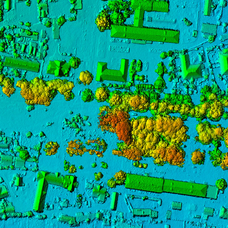
A Digital Surface Model (DSM) represents the Earth's surface as-is, including all natural and man-made features. It captures elevation data from the ground and any objects on it, such as buildings, vegetation, and other structures.
002 - Advantages
What are the key strengths of DTMs & DSMs?
Harness the power of technology for superior planning, monitoring, and decision-making in your projects.
What are the main benefits of DEMs, DTMs or DSMs?
Digital Elevation Models (DEMs) benefit from being easily-transferable, retaining crucial information which can be exported into common industry formats across many sectors.
Terrain Information & Modelling
DTMs & DSMs provide a basis for understanding the 3D characteristics of land surfaces and slopes, and real-world environmental forecasting and modelling.
Efficient Elevation Visualisation
DTMs & DSMs provide the capability of being quickly turned into contour maps or a colour-scale for easy identification of a landscape or surface’s elevation.
Bare Earth Surface Analysis
DTMs have a unique capability to strip away man-made and natural features on the earth's surface, allowing for visualisation of the bare underlying terrain.

Coming Soon: Digital Elevation Model Demo
003 - Industry Sectors
How will DTMs or DSMs benefit my project?
We leverage cutting-edge UAV imaging technologies tailored to meet specific project needs.
Architecture, Engineering and Construction
Topographic Mapping
Detailed elevation data for creating accurate topographic maps used in various applications like urban planning, construction, and land use management.
Site Planning
Help engineers and architects in planning construction sites by providing detailed information about the terrain, allowing for better project and risk management.
Utilities & Infrastructure
Infrastructure Development
They are used in the design and construction of infrastructure such as roads, bridges, and tunnels, ensuring that they are built in the most suitable locations.
Telecommunication Network Planning
Planning cell tower and antenna placement for optimal coverage, allowing for the identification of potential signal obstructions, and line-of-sight analysis.
Environmental Management
Forest Management
Assessing forest structure, planning sustainable logging operations and capturing the height of forest canopies to aid in biomass estimation and habitat monitoring.
Flood Risk and Water Drainage Assessment
Used as a basis to model water flow, watersheds and drainage patterns, helping predict/manage flood risks by identifying flood-prone areas.
Renewable Energy
Wind Turbine Placement
Assisting in determining the best placement for turbines, how wind flows over the terrain and how it will interact with turbine blades and influence power output.
Solar Energy Planning
Assessing solar potential and shading effects, ensuring the strategic placement of solar panels for maximum efficiency and energy yields with shading mitigated.
Farming & Agriculture
Biomass Estimation
DTMs allow for a base from soil-level from which to measure the crops above, and calculate the biomass of crops present in farmers’ fields for further analysis.
Arable Crop Orientation
DEMs can allow the optimisation of planting along south-facing slopes, where higher levels of sunlight are required to boost annual growth of arable crops.
Disaster Management
Erosion Control
Help in analysing erosion patterns and planning mitigation strategies to prevent soil loss, land degradation and land slips.
Damage Assessment
Assessing damage to buildings and infrastructure post-disaster, allowing informed decision-making to help emergency responders and streamline recovery efforts.
004 - FAQ
Want to find out more?
Everything you need to know about our Digital Elevation Models.
DTMs are now commonly produced by both LiDAR and photogrammetry processing software, which aims to identify the ground surface first, then strip away points above that surface and interpolate the value of the ground surface under those objects.
This depends on several aspects of the data capture and processing procedures used. Using UAVs, it is possible to collect data which can produce DSMs or DTMs accurate to within a few centimetres if processed correctly.
Small sites, down to the level of individual properties can benefit from DTMs/DSMs covering their properties in fine detail. UAVs are capable of efficiently and cost-effectively mapping very large areas in high detail, which in the past may have required chartering a manned aircraft.
A range of software used in different industries, such as CAD, GIS and BIM, are all capable of importing DSMs and DTMs, due to their simple file type.
005 - Contact
Have a project to discuss?
Have a project to discuss? Get in touch for a quote.