001 - Overview
What is a Thermal Survey?
Understanding the terms and appropriate uses is essential for achieving the right outcome for your project.

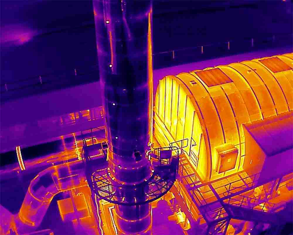
Thermal UAV Surveys involves capturing thermal infrared images using specialised thermographic cameras, which detect and measure temperature differences on the surfaces.
What are the most common uses of Thermal UAV Surveys?
Two of the most common uses of thermal surveys are thermal insulation surveys and solar installation surveys, which have important differences in the method of data capture.
Thermal Insulation
Insulation surveys take advantage pre-dawn or post-dusk conditions, ensuring the coolest temperatures to highlight thermal differences in defective insulation.
Solar Panel Installations
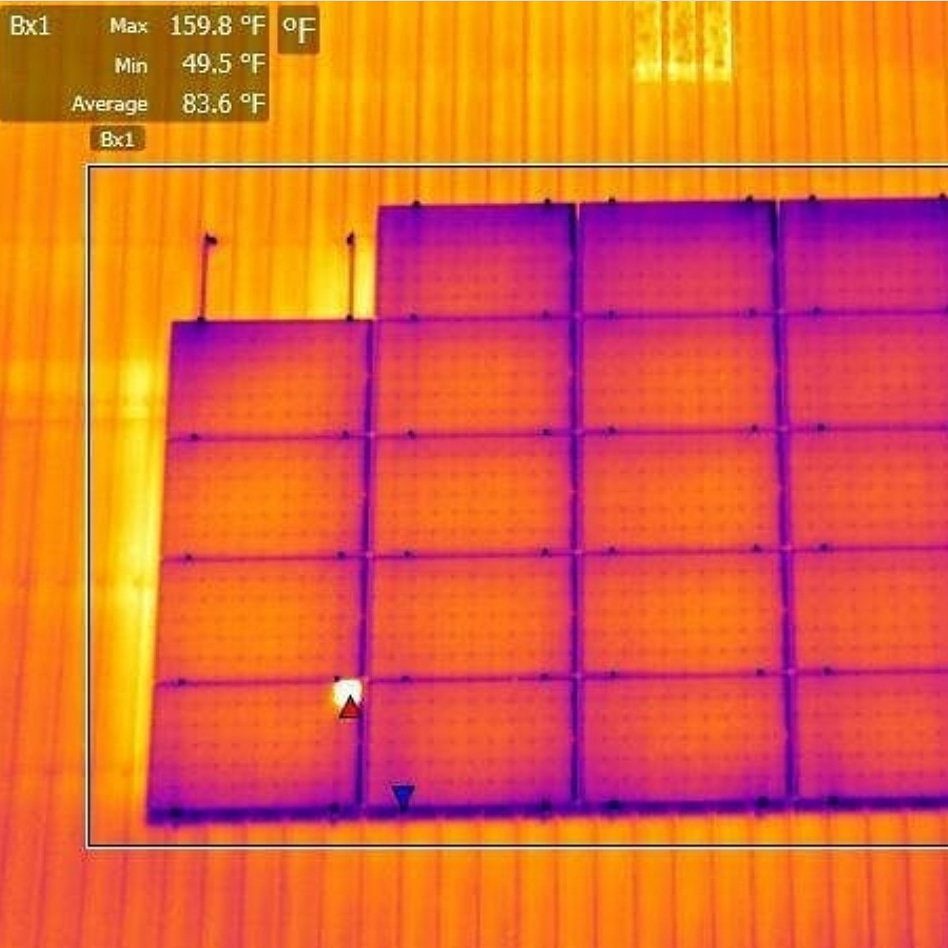
Solar panel installation surveys are best performed when solar irradiance is highest, ideally during the warmer months of the year with maximum solar loading.
002 - Advantages
What are the key strengths of Thermal Surveys?
Harness the power of technology for superior planning, monitoring, and decision-making in your projects.
What are the main benefits of Thermal UAV Surveys?
Thermal UAV surveys benefit from high efficiency and an ability to easily image areas from angles which are essential to correct reporting in comparison to ground-based surveys.
Accurate & Non-Intrusive
Thermography allows for highly spatially accurate detection of temperature variations without physical contact, making it ideal for delicate or hazardous areas.
Hazardous & Inaccessible Areas
UAVs can easily access remote or otherwise difficult-to-reach locations, which is particularly valuable for infrastructure inspection and environmental monitoring.
Rapid Deployment & Real-Time Data
UAVs can be quickly deployed to capture real-time thermal data, which is crucial for time-sensitive application such as emergency response and disaster management.

Coming Soon: Thermal Survey Demo
003 - Industry Sectors
How will Thermal Surveys benefit my project?
We leverage cutting-edge UAV imaging technologies tailored to meet specific project needs.
Surveying & Property
Heat Loss Detection
Identify heat leaks and insulation issues in buildings to improve energy efficiency, and detect potential areas of moisture entrapment and water infiltration.
Solar Panel Installations
Help surveyors and engineers to identify malfunctioning PV cells or panels, ensuring optimal performance of solar installations and targeted repairs.
Mechanical & Electrical Systems
Industrial Equipment Monitoring
Monitor the thermal performance of industrial machinery, including HVAC equipment, detecting areas of overheating in order to extend their lifespan.
Power Lines & Substations
Identify overheating components and potential failure points to prevent equipment failure, and ensure operational longevity with minimal risk.
Urban Planning & Development
Heat Island Analysis
Thermal surveys can be used to study urban heat islands, where densely populated areas experience hotter temperatures, for strategies in reducing heat in cities.
Infrastructure Development
Monitoring the thermal performance of new construction projects, from inception to completion, ensuring that work activities meet design and safety specificiations.
Environmental Management
Wildlife Studies
Tracking and monitoring animal populations based on their thermal heat signatures, particular used in dense and low-light conditions where observation is difficult.
Pre-Post Disaster Change
Enabling efficient visualisation of change over very wide area due to natural disasters, which in turn allows for effective targeting of resources.
Agriculture & Farming
Irrigation Management
Monitoring soil moisture levels and crop health to optimise irrigation practices, and avoiding issues such as overwatering and unnecessary waste of water resources.
Pest & Disease Detection
Identify crops affected by pests or diseases through temperature variations, allowing for identification of infestations otherwise invisible to the naked eye.
Emergency Response
Search & Rescue
Thermal surveys can be essential is locating missing persons based on their heat signatures, particularly in challenging terrains or low-visibility conditions.
Disaster Damage Assessment
Assessing damage to buildings and critical infrastructure after natural disasters, such as floods or earthquakes, for effective and coordinated relief efforts.
004 - FAQ
Want to find out more?
Everything you need to know about our Thermal Surveys.
It is best practice to conduct thermal surveys during the hours when the sun is situated at or near its highest point in the sky, and ideally when irradiance levels are greater than 600W/m2 as set out in the IEC 62446-3:2017 standards for thermal surveying. Doing this ensures that irradiance levels are highest, and hence, that solar panel operation is at its maximum, which in turn allows any issues and defects to be highlighted during the thermal survey.
We will discuss this beforehand to ensure that we deliver the results in a way that’s best for you. This will include a detailed thermal report as well as suggestions to remedy any existing issues identified during the survey.
Conversely to solar panel surveys, during the early morning or late evening hours, contrast is highest between the coolest outdoor temperatures and warmer temperatures inside dwellings. This allows for thermal anomalies to be highlighted during data capture.
005 - Contact
Have a project to discuss?
Have a project to discuss? Get in touch for a quote.