001 - Overview
What is Volumetric Assessment?
Understanding the terms and appropriate uses is essential for achieving the right outcome for your project.

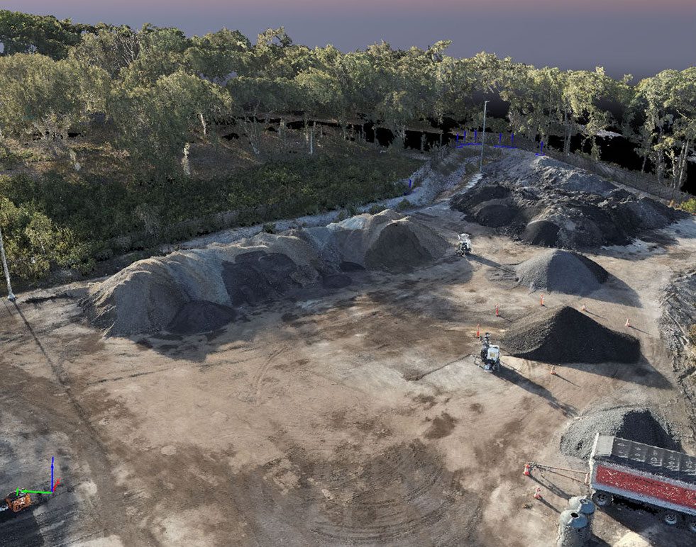
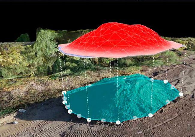
Volumetric assessments provides critical insights across various industries by accurately measuring and analysing volumes of materials and spaces.
What are the differences between LiDAR & Photogrammetry?
Volumetric surveys undertaken by UAVs allow for fast, efficient data capture with minimal disruption to site activities, which can be conducted with multiple imaging technologies.
Photogrammetry
Photogrammetry can produce highly dense point clouds, ideal as a basis for volumetric analysis, and with minimal hardware and processing time. Learn More.
LiDAR
LiDAR scanners usually have an additional attribute – intensity – which may include information such as texture or roughness of a surface. Learn More.
002 - Advantages
What are the key strengths of Volumetric Assessments?
Harness the power of technology for superior planning, monitoring, and decision-making in your projects.
What are the main benefits of Volumetric Assessments?
Point clouds form the basis of a Volumetric Assessment, and are precursors to several different types of 3D and 2.5D model products such as DTMs & DSMs.
Accurate Stockpile Measurement
Analyse precise volume calculations of materials like soil, aggregate, or waste, ensuring efficient inventory management and cost control.
Reduced Risk & Non-Intrusive
Volumetric reports can be quickly generated by using UAVs to fly over the site with minimal disruption to site operations in comparison to traditional methods.
Comprehensive Coverage
UAV-based scanners can capture material stockpiles from all angles, minimising model estimation and leading to the highest accuracies possible.

Coming Soon: Volumetric Assessment Demo
003 - Industry Sectors
How will Volumetric Assessments benefit my project?
We leverage cutting-edge UAV imaging technologies tailored to meet specific project needs.
Mining & Quarrying
Stockpile Management
Measuring the volume of stockpiles to manage inventory and operational logistics, providing a sustainable alternative to traditional methods of data capture.
Resource Estimation
Determining the volume of extracted minerals, ores and overburden, ensuring optimisation of pit designs and extraction processes based on volumetric data.
Construction & Earthworks
Cut & Fill Calculations
Estimating the volume of earth to be moved for leveling, excavation and backfilling, while measuring the volume of construction materials on site.
Project Progress Tracking
Repeat missions over a construction project's lifecycle, monitoring the volume of earthworks completed to assess project progress and manage programme.
Oil & Gas
Tank & Pipeline Management
Measuring the volume of storage tanks and pipelines for inventory and flow management, and regularly estimating the volume of oil and gas reserves.
Fracture Analysis
Calculating the volume of pipeline fractures and voids in subsurface formations, ensuring informed decision-making and minimising environmental impact.
Logistics & Warehousing
Inventory Management
Monitoring the volume of goods for efficient storage and logistics planning, optimising warehouse space by calculating available and used volumes.
Waste Management
Calculating the volume of waste in landfills to manage capacity and lifespan, and assessing recyclable and compostable materials for processing and logistics.
Agriculture & Farming
Crop Storage
Estimating the volume of storage bins and silos for grain and other crops, ensuring accurate capacity planning and efficient crop storage to minimise waste.
Soil & Irrigation Management
Obtaining accurate soil volumes for activities like tillage, plowing, and terracing, and measuring the volume of water bodies, reservoirs, and irrigation channels.
Environmental Management
Erosion Control
Measuring soil loss or accumulation volumes for comprehensive erosion management, and estimating sediment volumes in rivers, lakes, and reservoirs.
Habitat Restoration
Estimating the volume of materials need for habitat restoration projects, and monitoring live natural habitats in hard-to-reach wildlife locations.
004 - FAQ
Want to find out more?
Everything you need to know about our Volumetric Assessments.
No, due to the non-intrusive nature of drone surveys, it is very unlikely that any activities on site will be affected, and depending on the size of the site, the survey is unlikely to require more than a couple of hours. It will of course be necessary that the stockpiles being measured remain untouched for the duration of the survey, so that they can be measured accurately.
While the final accuracy will depend on several factors, such as how close the drone is able to fly to a stockpile, UAV surveys have been shown to be more accurate than ground-based volumetric surveys, and can certainly be achieved much faster.
We will discuss your preferences to ensure that we deliver the results in a way that’s best for you. This will include a detailed volumetric report, along with hosting a 3D digital copy of your site, accessible through your browser, which includes the ability to view, annotate and apply other types of measurements at the touch of a button.
005 - Contact
Have a project to discuss?
Have a project to discuss? Get in touch for a quote.