Demonstrating GSD-Altitude, Volumetric Analysis, and Object Movement
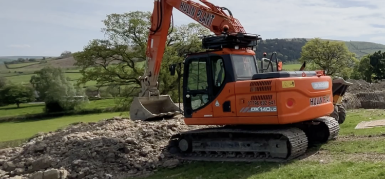
Survey Air recently undertook a project to map a property situated in Powys, Wales. The mixed-use site consisted of a motorhome park, several grazing fields, a natural quarry and stockpiles of landscaping materials.
The varied features present on-site provided the perfect opportunity to demonstrate several aspects of mapping and 3D modelling using the DJI Mavic 3 Enterprise UAV and Real-Time Kinematic (RTK) technology.
The UAV mission had 3 major aims:
- Varied-Altitude Operations: Flying at altitudes of 35m, 75m and 110m, demonstrating the difference in resolution at different heights.
- Precision in Movement Detection: Demonstrating the ability to detect movements with centimeter-level precision.
- Cut and Fill Analysis: Conducting cut and fill analysis in the quarry area, showcasing the visualisations that can be achieved.
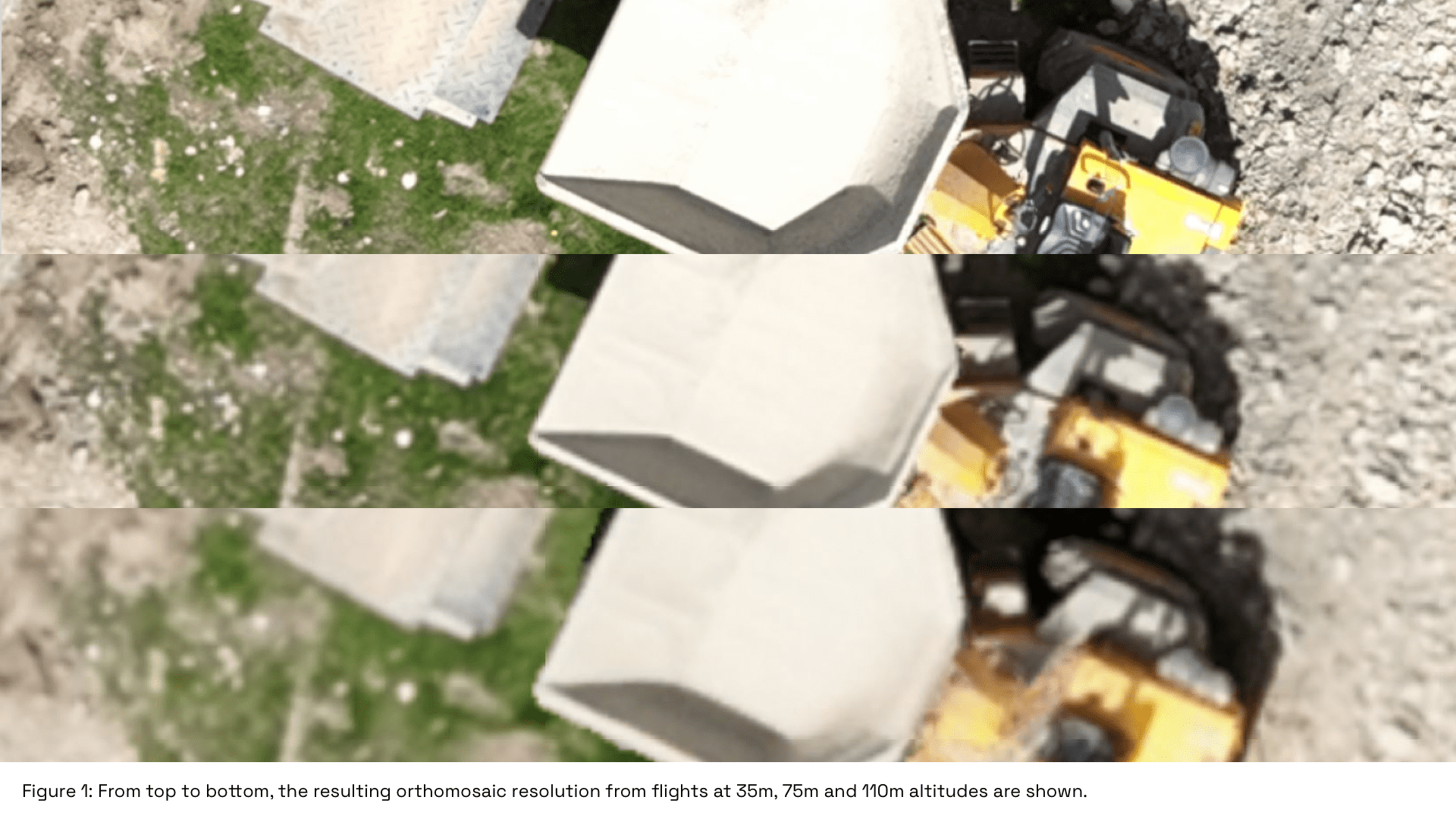
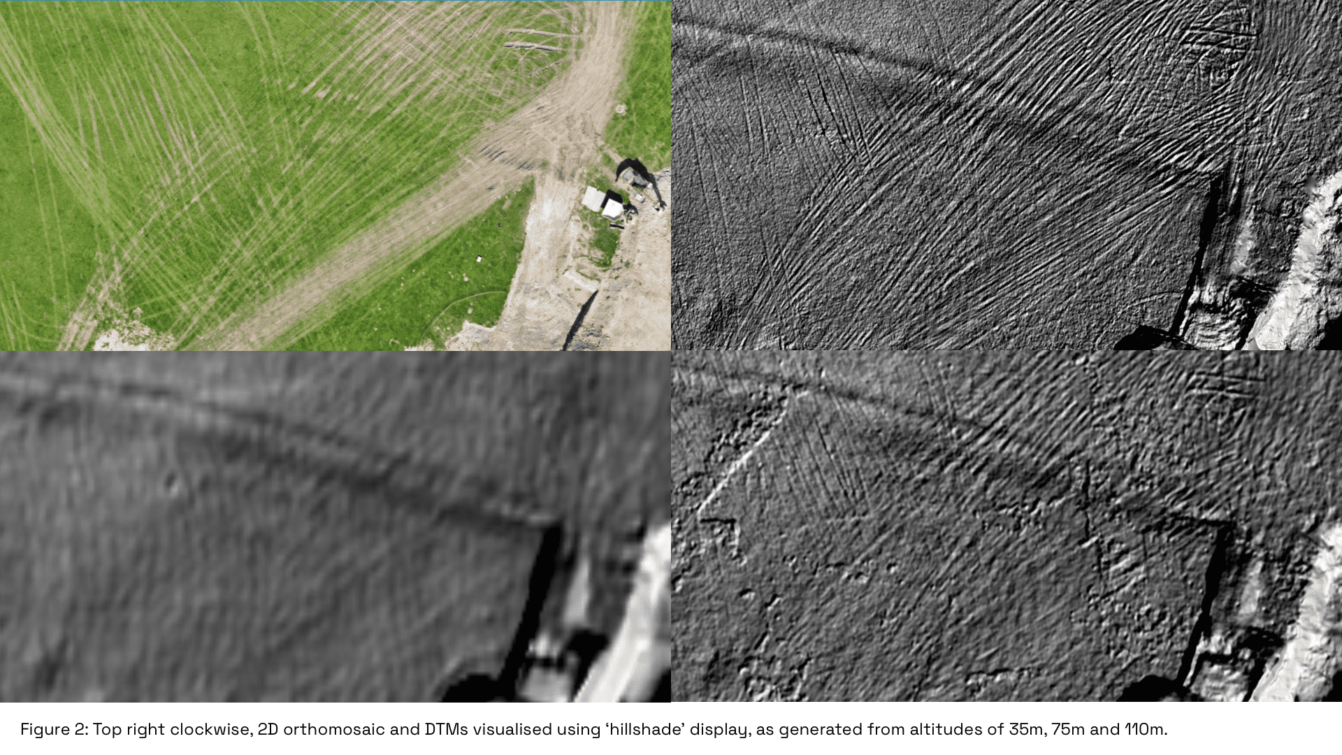
GSD at Different Altitudes: 35m, 75m and 110m
As the distance between the camera and the surface increases, the ‘resolution’ decreases. Hence, flying at higher altitudes, (e.g. 100m+) means a slightly lower ‘resolution’ and limit the surface features which can be accurately modelled.
On the other hand, a higher altitude allows for a wider area to be captured in a single pass of the UAV, meaning that operations which do not require ultra-high levels of resolution can be completed more efficiently.
With this in mind, we wanted to show a visual comparison of terrain models at 3 different altitudes: 35m, 75m and 110m. The results can be seen in the images below.
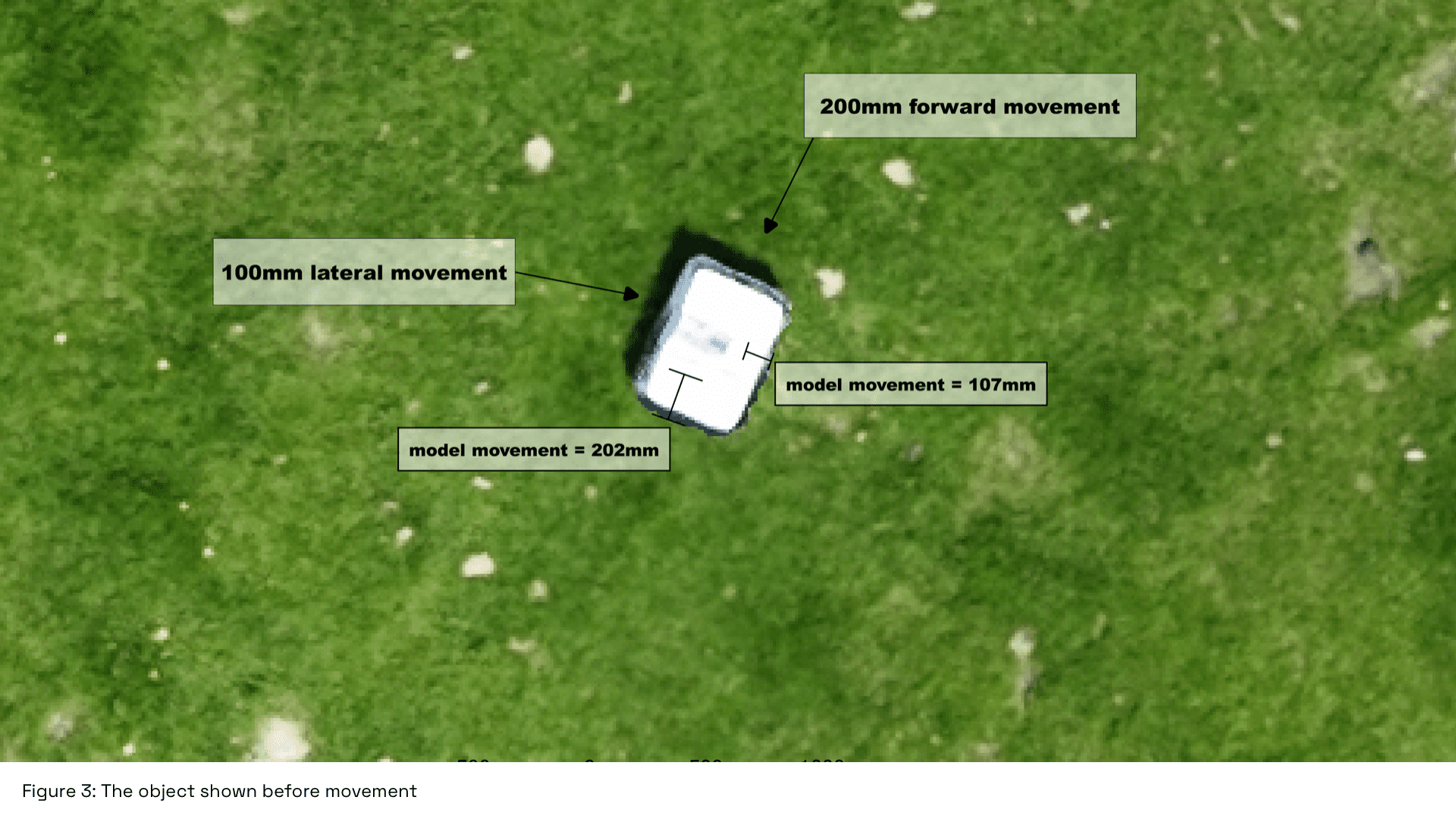
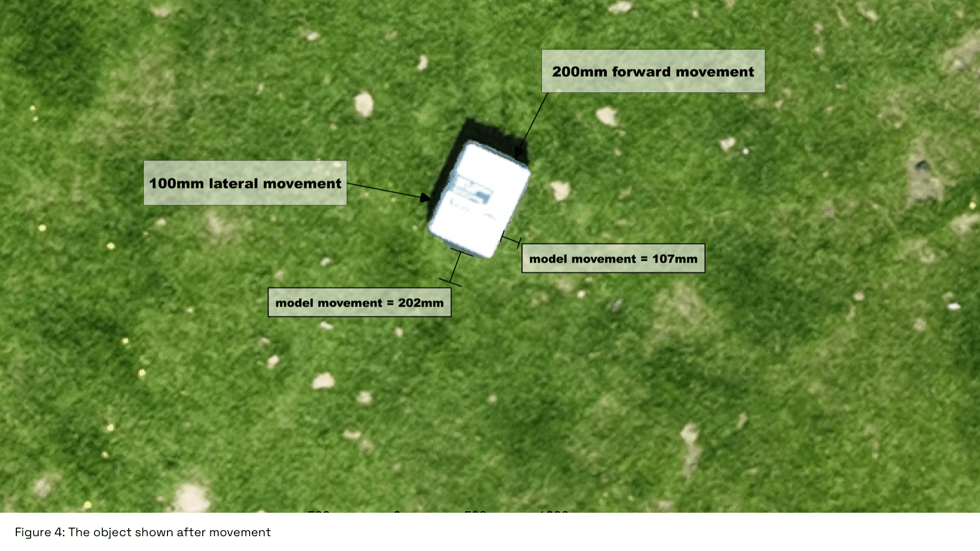
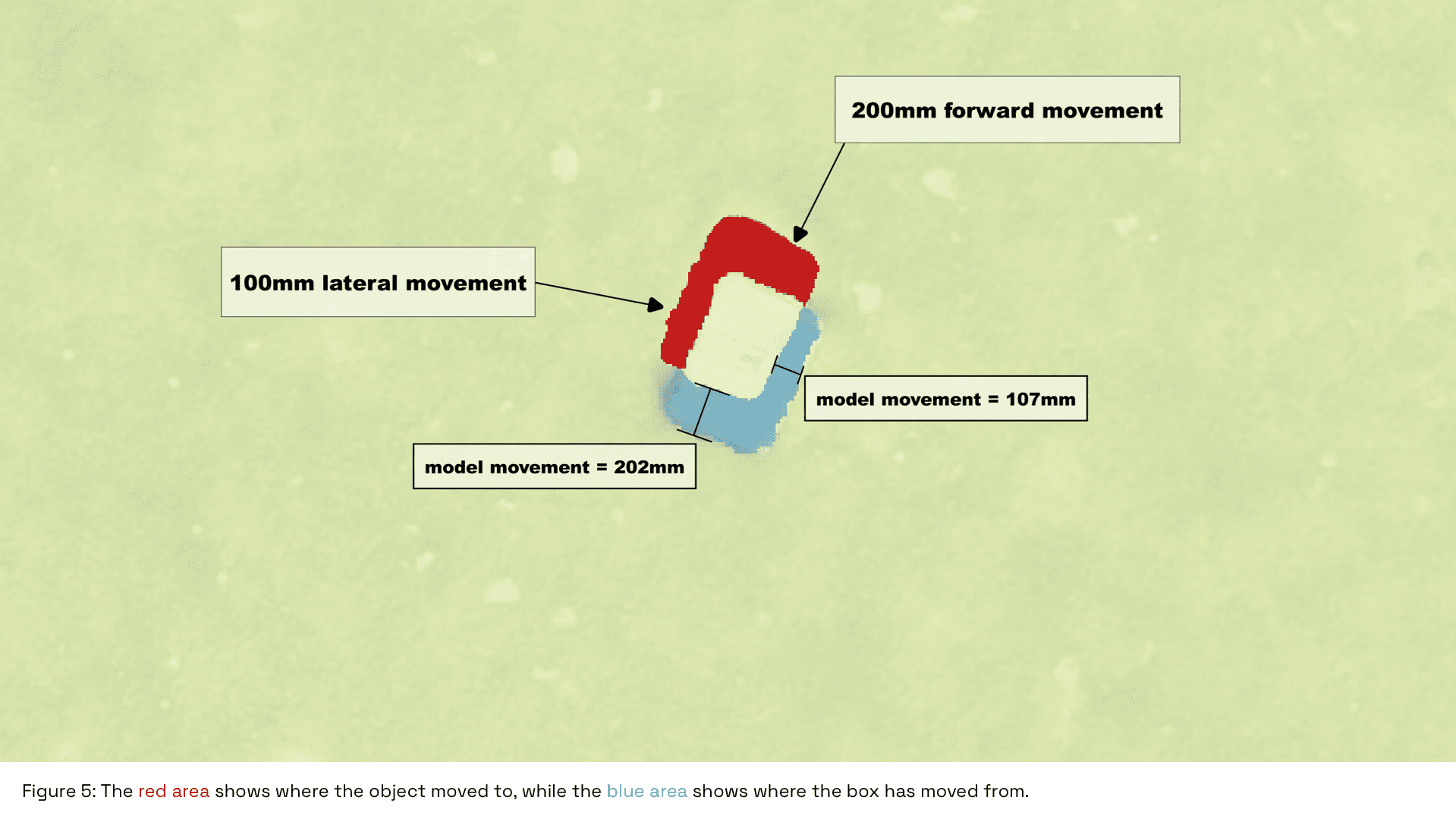
Movement Detection at the Centimeter Level
The object in the image is moved 10cm in a ‘forward’ position and 20cm in a lateral direction, see images below, which was verified through precise measurements taken ‘in-situ’ on the ground.
The movement measured by the drone was 107mm and 202mm respectively, meaning that the difference between the UAV’s measurement and ground measurement was sub-centimeter.
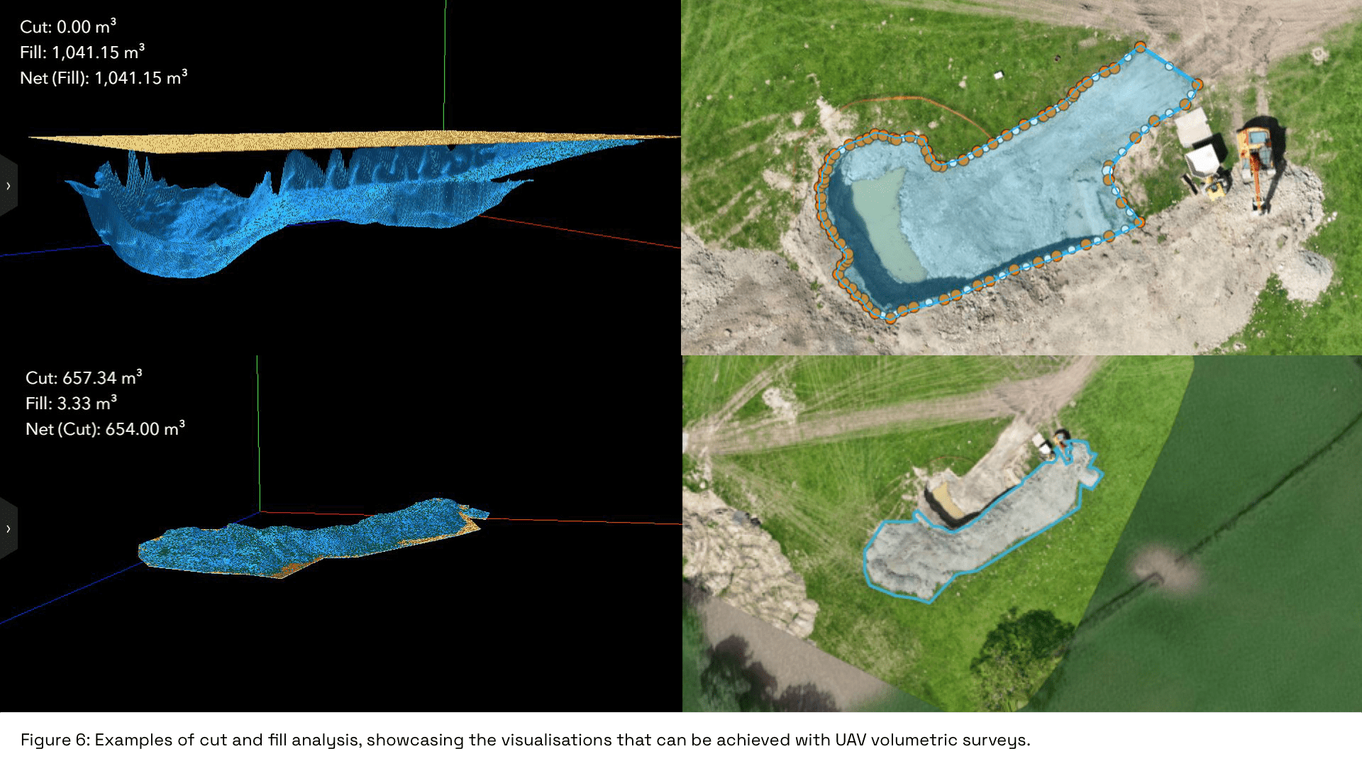
Volumetric Survey
The high-resolution data captured at 35m also allowed for an accurate volumetric survey. Stockpile and extraction pit shapes and sizes were precisely visualised, to generate a cut and fill analysis.
Approximately 1041.15m³ of material was extracted to create a pit of equivalent size, while approximately 657.34m³ of material is left from the extraction above the surface.
Conclusion
Our project in Powys stands as a testament to the advanced capabilities of modern UAV technology in mapping and 3D modeling.
The successful demonstration across various altitudes and applications underlines the versatility and precision of these tools, opening new avenues for accurate environmental monitoring, resource management, and infrastructure planning.
Contact Us
At Survey Air, we offer specialist drone mapping services tailored for various industries, including products such as 3D building models, 2D orthomosaic maps and volumetrics.
If you are interested in using our services for your next survey or project, please contact our expert team today to request a free quote and consultation.