Drone Survey Data Management, Security & Delivery

Drone survey data management is a critical step in turning raw aerial imagery into reliable spatial information. When most people think about drone surveying, they focus on the aircraft: high-performance UAVs capturing imagery above sites and complex infrastructure. In reality, data capture is only the first step. Without a structured process for handling the large volumes of spatial information collected during flight, even the most precise mission delivers limited value.
At Survey Air, UAV operations are only one part of the workflow. Our focus is the engineering and management of high-accuracy aerial survey data, ensuring that every dataset can be trusted, integrated into existing workflows, and used to support critical project decisions.
This article provides a technical overview of how we manage UAV survey data from capture to delivery. The key objectives of our data handling process are:
- Data Processing: Transforming raw drone imagery and LiDAR datasets into accurate geospatial models.
- Data Security: Protecting sensitive spatial information throughout the entire processing pipeline.
- Data Delivery: Providing accessible, interoperable datasets that integrate directly with CAD, BIM, and GIS platforms.
Data Processing Pipeline
Converting raw UAV imagery into survey-grade deliverables requires significant computational processing and geospatial expertise. A single aerial survey can generate thousands of high-resolution photographs and millions of LiDAR points. These datasets must be processed, classified and validated before they can be reliably used for surveying, engineering or construction projects.
High-density point cloud generated from UAV mapping data used for measurement, modelling and terrain analysis.
Once a UAV mission is completed, all captured data is securely transferred to our processing infrastructure. From there, it enters a structured geospatial workflow designed to refine raw aerial data into accurate spatial models.
The first stage involves organising and indexing the imagery and LiDAR data before running photogrammetric alignment and point cloud generation. Automated classification algorithms then categorise the dataset into key surface types such as terrain, buildings, and vegetation.
The dataset is subsequently filtered to remove transient elements captured during flight, including vehicles, moving equipment or personnel. This ensures the resulting models represent a stable and measurable record of the site.
Finally, each dataset is validated against ground control points (GCPs) and survey benchmarks to verify positional accuracy.
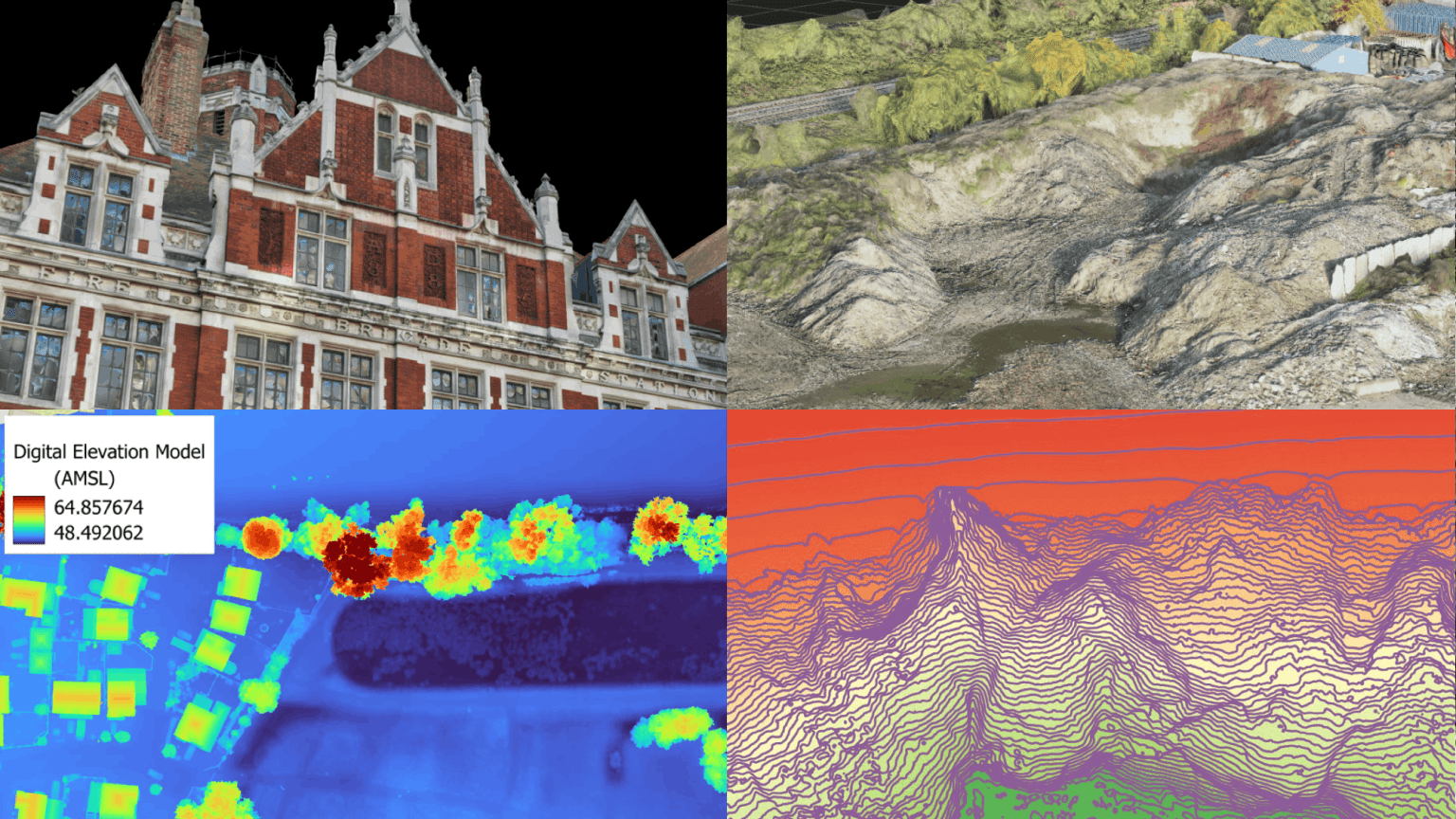
UAV mapping deliverables generated from processed drone survey data.
The output of this process is a suite of survey-grade deliverables tailored to each project. Typical deliverables include:
- 3D point clouds containing millions of precisely georeferenced measurement points.
- Digital twin models that provide detailed textured representations of buildings and infrastructure.
- Orthomosaic maps, geometrically corrected aerial images suitable for accurate measurement and planning.
- Volumetric reports used for stockpile monitoring and earthworks management.
Every dataset undergoes a formal quality assurance review before delivery. Because our workflows are built around professional surveying standards, data accuracy and reliability remain the primary priority.
Data Security
In commercial drone surveying projects, aerial survey data often contains sensitive information, including infrastructure layouts, construction progress and architectural designs. Protecting this information is therefore a core part of our data management process.
Survey Air operates with procedures aligned to the Royal Institution of Chartered Surveyors (RICS) professional standards. These protocols govern how spatial data is captured, processed and stored across all projects.

UAV spatial data secured through encrypted storage and controlled access protocols.
Data security begins immediately after capture. All datasets are transferred from the UAV payload using encrypted storage protocols before being uploaded to our secure processing infrastructure. Encryption is maintained throughout the entire data lifecycle, ensuring files remain protected both in transit and at rest.
Access to project data is controlled through strict internal permission systems. Only the geospatial technicians and surveyors assigned to a specific project are authorised to access the relevant datasets. Each stage of the processing pipeline is recorded through internal audit logs, providing full traceability of data access and processing activities.

Survey Air uses secure UK-hosted infrastructure for processing and storing aerial survey datasets.
To maintain compliance with UK data protection legislation, all project data is stored on secure UK-based server infrastructure. We also operate a controlled data retention policy, ensuring spatial datasets are only retained for the duration necessary to complete project deliverables and agreed follow-up work.
Data Delivery & Client Portal
Once processing and quality assurance are complete, all deliverables are made available through the Survey Air Portal, our secure online platform designed specifically for managing UAV survey data.
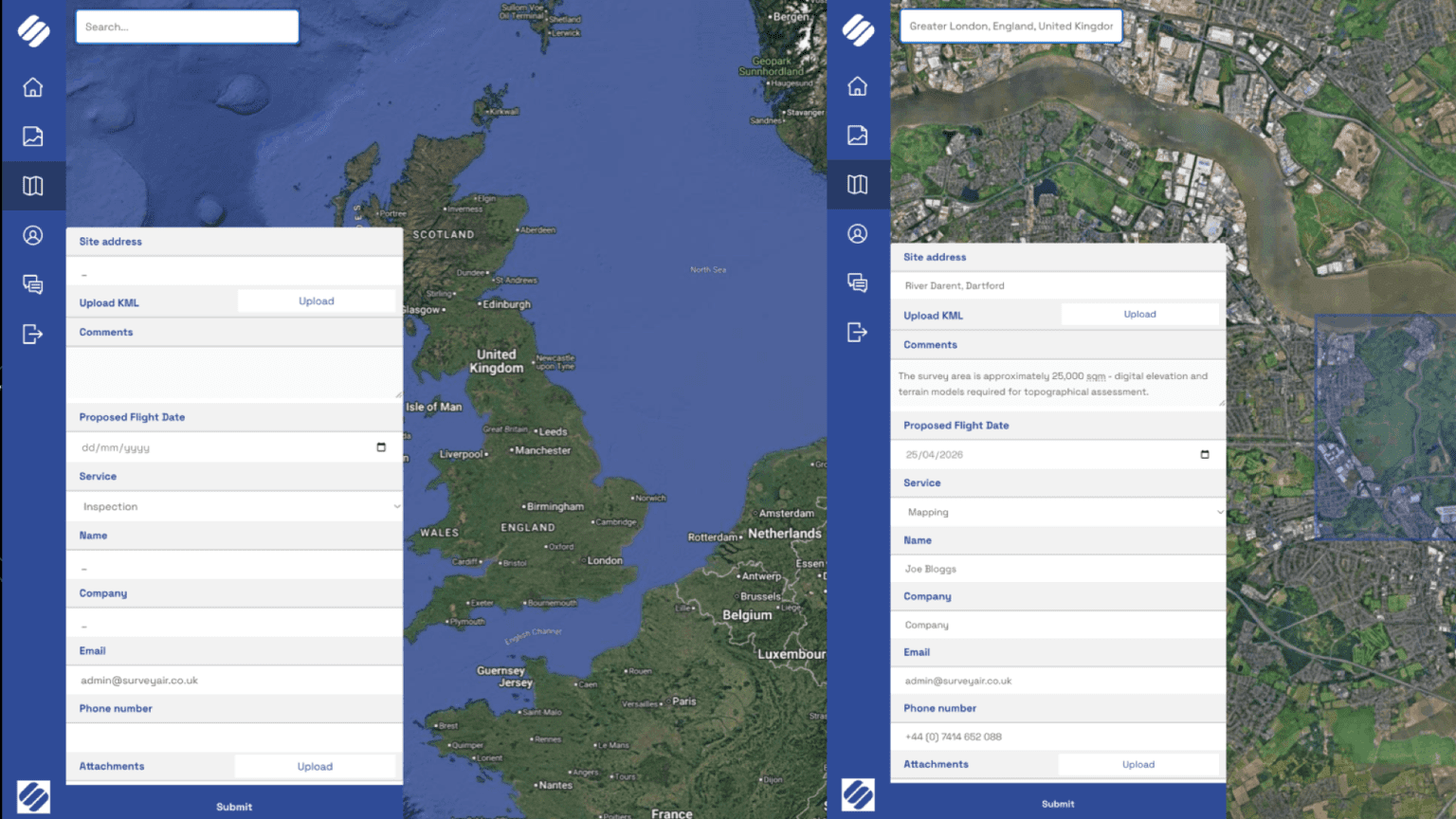
Clients can define survey areas and request quotes directly through the Survey Air portal.
Rather than relying solely on external transfer services or physical storage devices, clients receive access to a dedicated project environment where all datasets can be viewed, downloaded and shared.
One of the key features of the platform is browser-hosted 3D visualisation. interactive digital twin models can be viewed directly in a standard web browser, allowing teams to inspect assets, take measurements and annotate features without requiring specialist hardware or software.
Processed datasets can also be securely downloaded at any time. Where collaboration is required, the portal allows clients to generate controlled viewing links for project stakeholders, enabling remote inspection and project review.
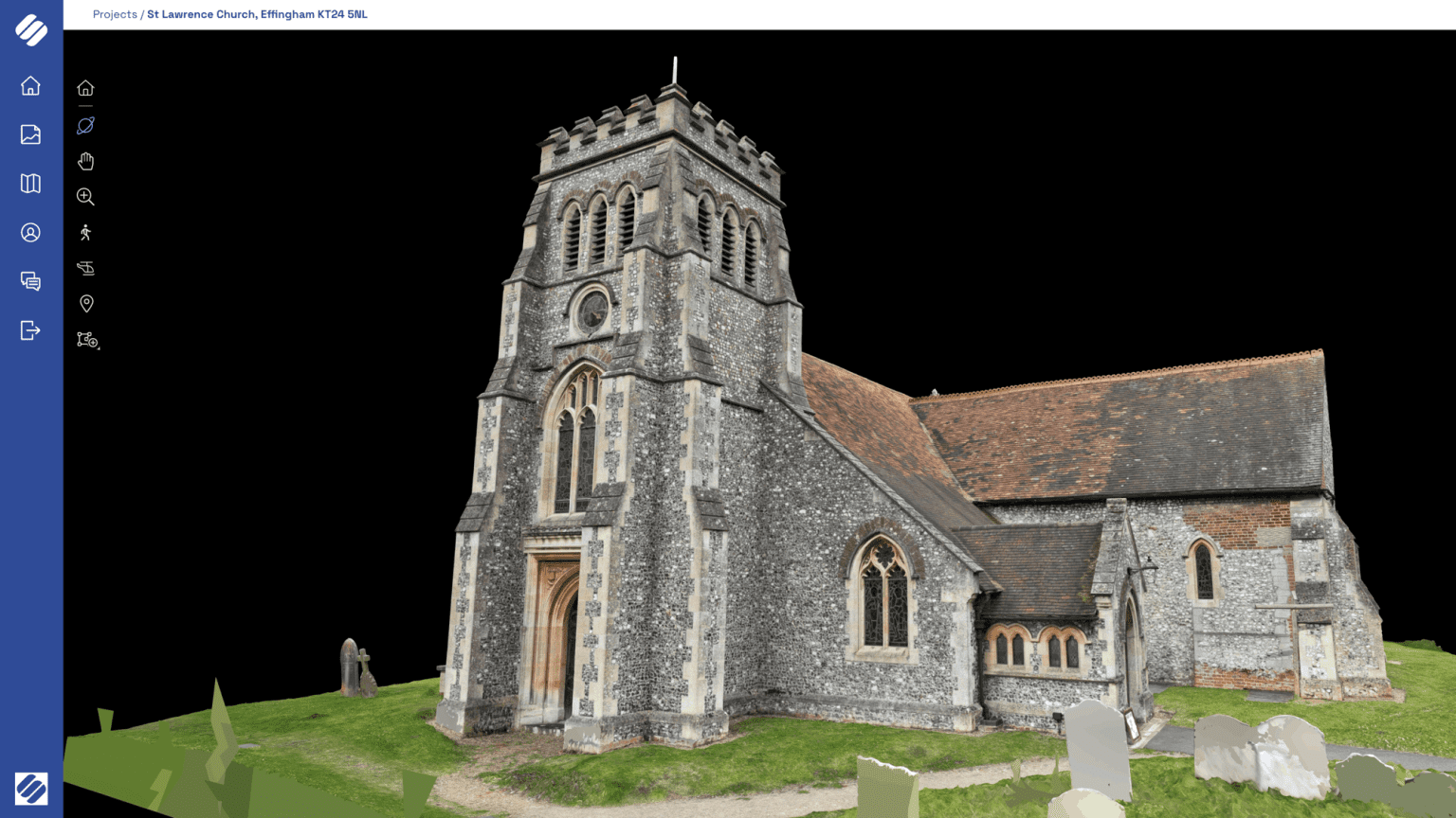
Browser-based 3D models allow clients to explore and measure UAV survey data without specialist software.
For integration into existing workflows, all deliverables are exported using widely adopted industry formats. CAD-ready files such as DWG and DXF support engineering design software, while GIS datasets including shapefiles and GeoJSON enable seamless import into mapping platforms such as ArcGIS and QGIS.
Classified LAS and LAZ point cloud formats are provided for advanced spatial analysis, alongside standardised reporting outputs for volumetric calculations and project documentation.
Contact Us
Survey Air provides specialist UAV survey services, delivering accurate drone mapping, modelling and inspection data through a secure processing pipeline.
If your organisation requires reliable UAV survey data for construction, infrastructure or engineering projects, contact our team to discuss your requirements and request a free consultation and quotation.