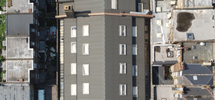
How Drone Technology is Revolutionising Surveying

Technology continues to change the way that we live, interact, go to school, go to work, build, and more. Technology of one sort or another seeps into every sector of life and land surveying is no different. Most people will think of drones to be used for military purposes and that’s certainly why they were first concocted, but the use and advancement of drones are actually having quite an impact on the industry of surveying. The use of this technology is impacting our industry so we thought we’d pay a little tribute to the drone and its use in land, property, infrastructure and construction sectors.
Drone Surveying – what is it?
The term drone survey refers to the use of a drone, or unmanned aerial vehicle (UAV), to gather aerial data with ultrasonic sensors and multispectral cameras. During drone surveys on survey sites, pilots deploy unmanned aerial vehicles (UAVs) to survey land and property in a shorter time than traditional surveying methods, which can save time and increase efficiency.
More companies are changing their surveying methods to take advantage of the new technologies becoming available. They are finding a much higher return on investment due to more accurate data being accumulated by fewer people in less time with quicker results. Not working with a modern surveyor employing the best techniques is far too expensive a proposition for many companies, and they are finding the change worthwhile.
How are drones changing the surveying industry
Drones are changing the surveying industry in a couple of ways and provide certain benefits like:
- Disruption: Surveyors often have to deal with disruption or boundaries that make getting a full survey a little more difficult. The operator using a drone does not have to worry about any disruption to the sightlines.
- Imagery: Images collected from a drone are not only accurate but high resolution and can serve a variety of purposes.
- Risk: The use of drones lowers the risk to the surveyor when it comes to difficult and dangerous terrain. Because of this, the safety of employees and workers is prioritised. Surveyors are tough and are used to navigating difficult places, but drones eliminate the need to put workers in unnecessary peril and get the job done with the same amount of accuracy, it’s a win-win.
- Survey speed: Using drones increases the rate of speed of receiving the information. Traditional surveying often requires carrying equipment and setting it up from one place to another. Drones can eliminate most, if not all of the need for this. Drone surveying means that you can do an entire area or construction site in one swoop and obtain accurate information.
- Efficiency and budget. As drones become more commonplace and specialised software becomes more familiar to the industry,, using drones can be a way to stay on budget and make better use of resources for a project. And who doesn’t love that! Whether it is a construction company or a government contract, saving on resources is always at the forefront.
Conclusion
At Survey Air, we carry out a wide range of drone services within the built and natural environment. All of our drone pilots are licensed and certified by the Civil Aviation Authority (CAA), having undergone extensive training and examinations to fly a drone for commercial purposes.
If you are interested in using our drone services for your project, please contact our drone surveying specialists today to discuss your options and find out more.