Mappleton UK Coastal Erosion Study
Survey Air have embarked on a long-term case study of a stretch of cliff side to the north of Mappleton’s coastal defences. The advancement of UAS technology means that surveying problem coastlines can be achieved more efficiently and more accurately.
The aim of the study is to fly recurring UAS missions, using aerial photogrammetry data to create 3D models (DEMs) of the cliff topology with pinpoint accuracy.
This UAS mission has three main objectives:
- Track Cliff Retreat: Compare multiple datasets over time to quantify the rate of cliff regression.
- Predict Future Collapse: Use historical data to anticipate future erosion patterns and areas of potential collapse.
- Support Mitigation: Provide valuable data for developing targeted erosion mitigation strategies.
Area Background
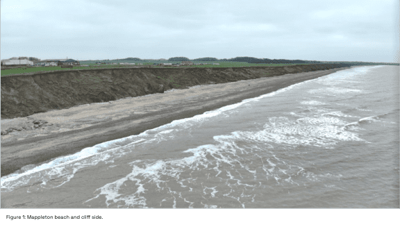
Mappleton is a small village of around 50 properties in the East Riding of Yorkshire located along the Holderness coast; the cliff line that suffers the highest rate of coastal erosion in Europe. Mappleton lies upon boulder clay that is soft and erodes very quickly, estimated at a rate of 2m every year, posing a significant threat to the villages homes and infrastructure.
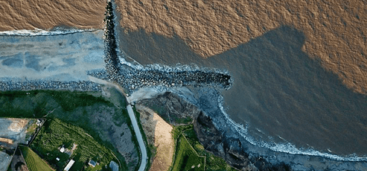
In 1991, Groynes (a wall of large boulders built out at right angles into the sea) were installed as sea defences, which has been seen to have some effect and has given some protection to a majority of the residential properties. However, these defences do not stretch far up the coast and there are some properties still suffering. Some studies have shown that the retreat in unprotected regions has worsened since the Groynes construction. Due to this continued erosion, several properties are likely to lose significant land in the next few years.
To provide critical insight into cliff erosion such as plotting rate of regression, identifying especially high-risk areas and even predicting future collapse, highly precise 3D topological models can be constructed using and overlaying geo-referenced images from UAS missions.
Capture Methodology
In November 2024, we conducted three flight missions using the DJI Mavic 3 Enterprise with the wide lens and constant RTK positioning correction.
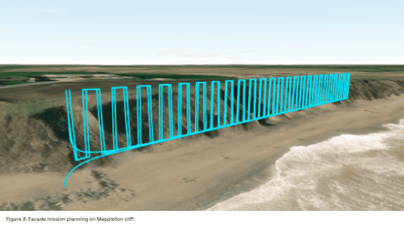
- Façade flights: The façade passes were made along a 200m stretch of beach. Each façade flight had a varied angle of yaw relative to the cliff face. This ensured as many elements of the cliff face were captured as possible.
- Horizontal Crosshatch: A crosshatch flight was conducted with the UAS terrain follow activated. The drone flew at a consistent 15m above ground level with gimbal angled to -75˚ relative to the horizon. The terrain follow means that we maintain high resolution images at all sections of the flight.
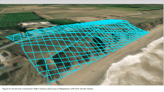
The images from all three missions were captured with 75% horizontal and vertical camera overlap; this overlap is vital to make sure the processing software can ‘stitch’ all the images together. After the mission was completed, the Images were loaded into specialist mapping software to create a geo-referenced 3D model.
To ensure accuracy was maintained, the model was tied to known, geo-referenced ground control points (GCPs). Aligning the model to these points corrects any positioning accuracy that may be present from the capture and confirms the model is spatially accurate.
Data Processing
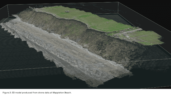
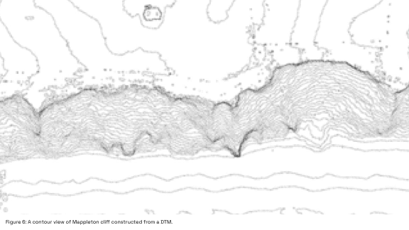
After completing the missions, a high density point cloud and textured 3D mesh were generated from the photogrammetry data and were used to produce a Digital Terrain Model (DTM), representing surface elevation and key terrain features. These will be the baseline for terrain comparisons we draw from return trips to Mappleton.
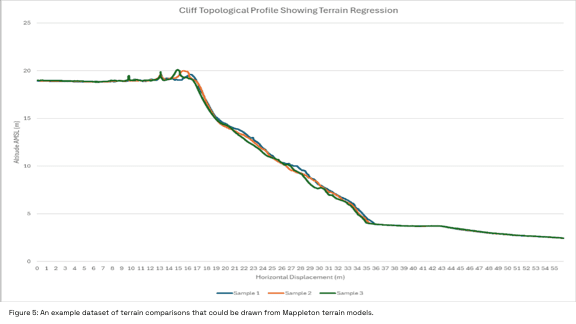
The 3D models do not provide us with much information alone. Once overlayed with the models produced from return trips, highlighting any points of difference in the terrain. instantly identifying areas where the cliff material has fallen away. As a result, we will be able to calculate the actual rate of regression and identify areas that are being affected more rapidly than others. With enough data, the cliff regression could even be predicted.
The data could be invaluable to both the local authorities and to landowners. New sea defences could be constructed in areas that have been highlighted as problematic, and by knowing the likely spots of future collapse in good time, landowners can put mitigations in place to reduce the financial impact they may incur.
Conclusion
We have successfully completed our first flight missions over the area, establishing the foundation for what we hope will be a long-term coastal monitoring study. Our next mission is scheduled several months from now, and we are prepared to deploy sooner if a significant storm impacts the area, potentially causing noticeable land shifts.
While this initial dataset is only the beginning, it provides a critical baseline for understanding coastal erosion in Mappleton. As we gather more data over time, we aim to build a comprehensive picture of how the coastline evolves, helping to inform strategies for protecting local homes and infrastructure.
Contact Us
At Survey Air, we advance UAV technology service by sharing our expertise to help clients unlock its full potential.
Whether you’re exploring the implications of coastal erosion, planning your first coastal survey, or looking to integrate drone data into your environmental assessments, our team is here to guide you.
If you’d like to learn more about how these developments could benefit your projects, contact our specialists for an informal discussion, tailored advice, or a free initial consultation.