Mappleton UK Coastal Erosion Study: Revisited
Following our initial Mappleton coastal erosion survey in late 2024, Survey Air returned in 2025 to continue monitoring one of the UK’s most rapidly changing coastlines.
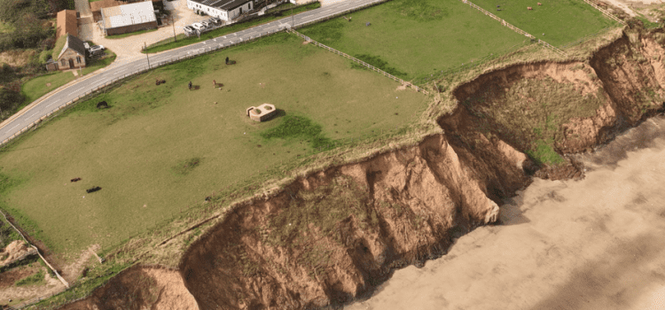
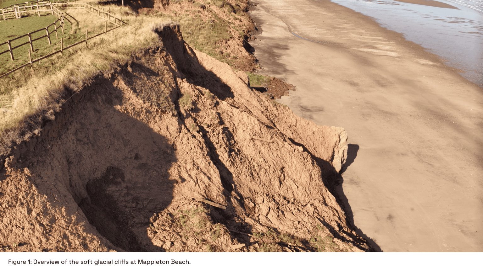
The soft glacial till cliffs of East Riding of Yorkshire are highly susceptible to wave action and storm events, resulting in annual land loss measured in metres. Repeat monitoring is critical for understanding long-term trends and supporting evidence-based coastal management, risk assessment, and environmental research.
While our first survey established a baseline for cliff morphology and erosion patterns, the second survey allowed us to track changes over time, identify emerging hotspots of instability, and refine our methods for consistent, repeatable UAV photogrammetry surveys.
This UAS mission has three main objectives:
- Track Cliff Retreat: Compare multiple datasets over time to quantify the rate of cliff regression.
- Predict Future Collapse: Use historical data to anticipate future erosion patterns and areas of potential collapse.
- Support Mitigation: Provide valuable data for developing targeted erosion mitigation strategies.
Advancing Coastal Monitoring with Repeat UAV Surveys
During this second visit, we leveraged drone mapping technology to capture precise, high-resolution data that builds on our original survey.
Using a DJI Mavic 3 Enterprise RTK drone, we executed automated flight plans designed to cover both the vertical cliff faces and the cliff top, achieving overlapping imagery for accurate photogrammetric reconstruction.
To ensure geospatial precision, we deployed Ground Control Points (GCPs) across stable sections of the cliff, measuring their exact coordinates using an Elmid Reach GNSS receiver tied to the British National Grid. These points provided a reference framework to align datasets across successive surveys, enabling centimetre-level detection of changes in cliff position, slope, and elevation.
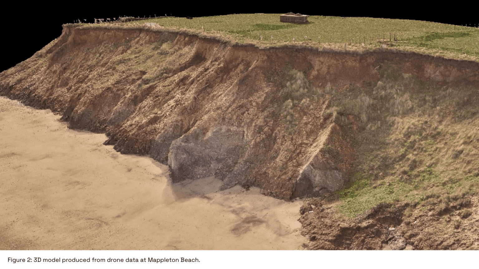
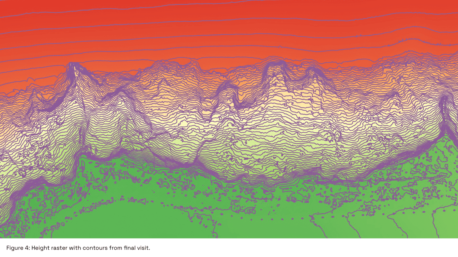
Captured imagery was processed in specialist photogrammetry software to produce dense 3D point clouds and digital elevation models (DEMs). These outputs form the backbone of our comparative analysis, allowing us to visualise and quantify subtle changes in cliff morphology that could indicate future collapses or accelerated erosion.
Key Insights from Comparing Repeat Drone Surveys
Comparing the new dataset with our initial survey revealed several important trends along the Mappleton coastline.
Variations in elevation of over 1m were recorded in several sections of the cliff face over the ten-month monitoring period, showing where large collapses had occurred. The workflow was sensitive enough to capture centimetre-scale surface movements, exposing subtle slope deformation that often precede larger failures.
By identifying and tracking the cliff precipice, we were able to measure horizontal retreat at the cliff top with precision. This is a direct metric of how much productive land was lost in less than a year. When plotted along the full length of the survey area, these measurements highlight both where the cliff is being consistently eroded and regions with more stability, giving a spatial overview of how the coastline is evolving.
These insights can provide early warning to landowners and local authorities. High-resolution 3D models and digital elevation data makes visualising erosion risk possible for non-technical audiences. With repeatable drone surveys conducted at set schedules or after harsh weather, councils can turn uncertainty into foresight, helping them plan, prioritise, and respond before valuable land and property are lost.
High-resolution 3D models and elevation data make this change visible to anyone, not just technical users. The ability to revisit identical flight paths means future surveys can be scheduled after major weather events or at regular intervals to maintain a continuous record of coastal behaviour. Each new dataset strengthens understanding of the rate, pattern, and potential triggers of regression, turning abstract risk into tangible evidence for planning and protection.
Benefits for Local Authorities, Landowners, and Researchers
The outputs of repeat drone surveys have wide-ranging applications for multiple stakeholders.
For local authorities and coastal engineers, detailed digital terrain models and topological comparisons inform the planning and prioritisation of coastal defence works, enabling targeted interventions in areas of greatest risk.
Landowners and property managers gain a clear picture of how much ground is being lost and where future retreat is likely, enabling informed decisions regarding the future of their property, farm boundaries, access and infrastructure protection.
Environmental and climate researchers benefit from high-resolution UAV datasets that allow them to study sediment transport, coastal dynamics, and the impact of extreme weather events and rising sea levels on soft cliff systems.
With repeat monitoring, Survey Air is helping to create a digital archive of the East Riding coast that shows exactly how the land is changing.
In practical terms, Survey Air is using UAV data to turn complex costal change Into something measurable and accessible to a range of end users. By creating an archive of costal change In the East Riding, decision makers are able to easily Identify and react to even subtle cliff movements and make data driven decisions to protect our coasts.
Conclusion
Survey Air is committed to long-term coastal erosion monitoring using repeat drone surveys and high-precision UAV photogrammetry.
By maintaining consistent survey protocols, we are building a valuable dataset to track erosion, assess mitigation strategies, and provide actionable insights for local authorities and communities along the East Riding coastline.
Contact Us
At Survey Air, we advance UAV technology service by sharing our expertise to help clients unlock its full potential.
If your organisation or local authority is exploring coastal monitoring solutions, drone mapping, or UAV-based surveys for environmental research or infrastructure management, contact Survey Air for expert guidance, tailored advice, and a free initial consultation.