3D Building Model of 12th Century Church
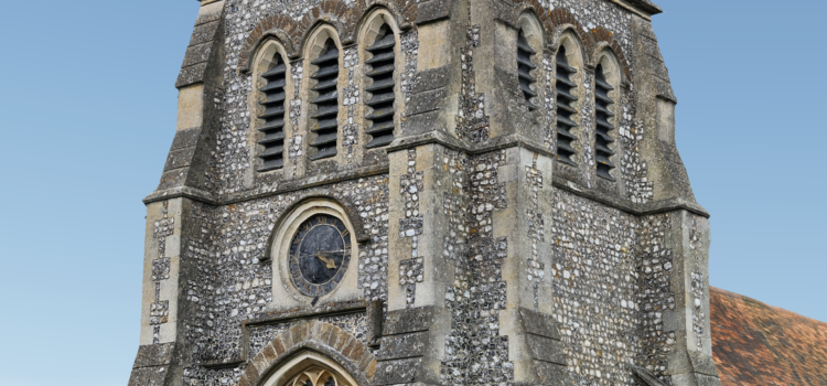
Survey Air conducted a recent drone survey of St Lawrence Church, a Grade II listed building dating back to the 12th Century. Featuring ornate crosses, stained glass windows and a stunning bell tower, the site provided the perfect subject to demonstrate our ability to create ultra-high resolution 3D building models.
The UAV operation would require meticulous flight planning due to surrounding vegetation and the irregular shape of the structure, ensuring that the drone stays within a few meters of the building to conduct a comprehensive data capture.
This UAS mission has three main objectives:
- Mission Planning: Plan and execute a complex UAV mission, ensuring safety while allowing for a high-quality data capture.
- Post-Processing: Demonstrate capabilities of collecting, editing and processing the data, using specialist photogrammetry software.
- Ultra-High Resolution: Produce a 3D building model capable of remotely inspecting roof and façade details in high resolution.
Mission Planning & Data Capture
To generate an ultra-high resolution 3D building model, it was necessary to ensure that the drone survey images were of the highest quality and consistency, therefore a largely automated approach was taken to capture the church.
Survey Air’s use of cutting-edge flight planning tools, along with RTK-enabled UAV technology, means that missions can be planned and operate within meters of even the most inaccessible areas of the structure being surveyed.
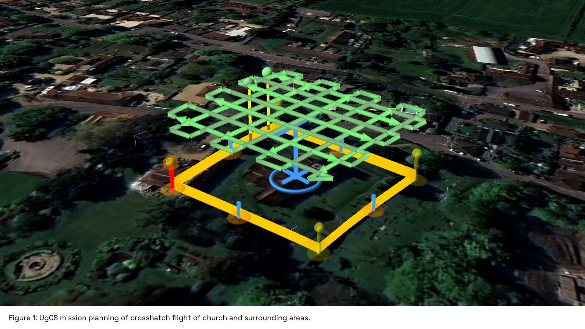
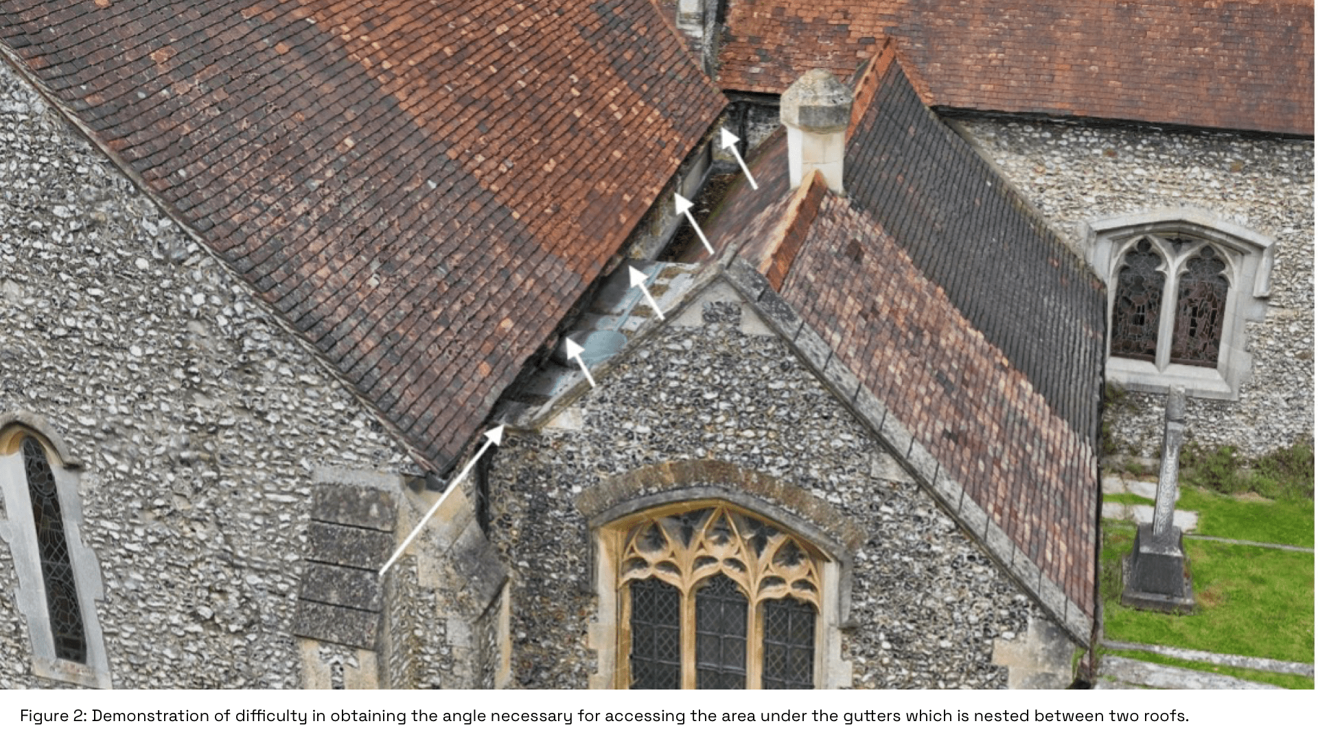
For example, on St Lawrence Church, there were several ornate features with highly angular surfaces and roofs overhanging each other at multiple levels, which would otherwise be hidden from view. This required robust flight planning and skilled UAV piloting to capture these areas efficiently and safely.
Processing Photogrammetry Data
To achieve the photorealism required for work at this level of detail, we utilised high-quality photogrammetry software, which ensures both a supreme level of accuracy, as well as the most optimal resolution for our clients’ purposes.
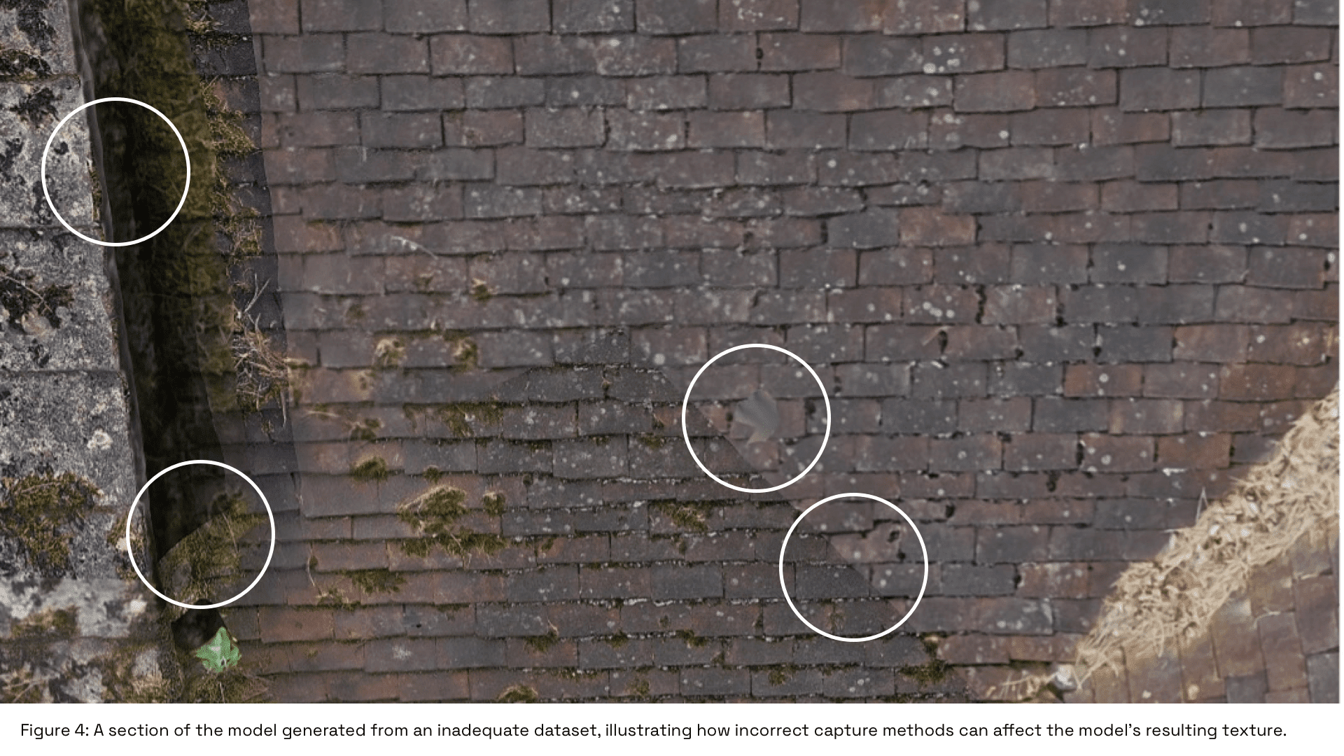
Reconstruction, which creates the structure of the physical surface of the building, relies on imaging the building from as many angles as possible. Equally however, processing too many images can cause losses in efficiency due to longer processing times, and changing shadows can sometimes be mistaken by photogrammetric software for topographical features on a building’s surface.
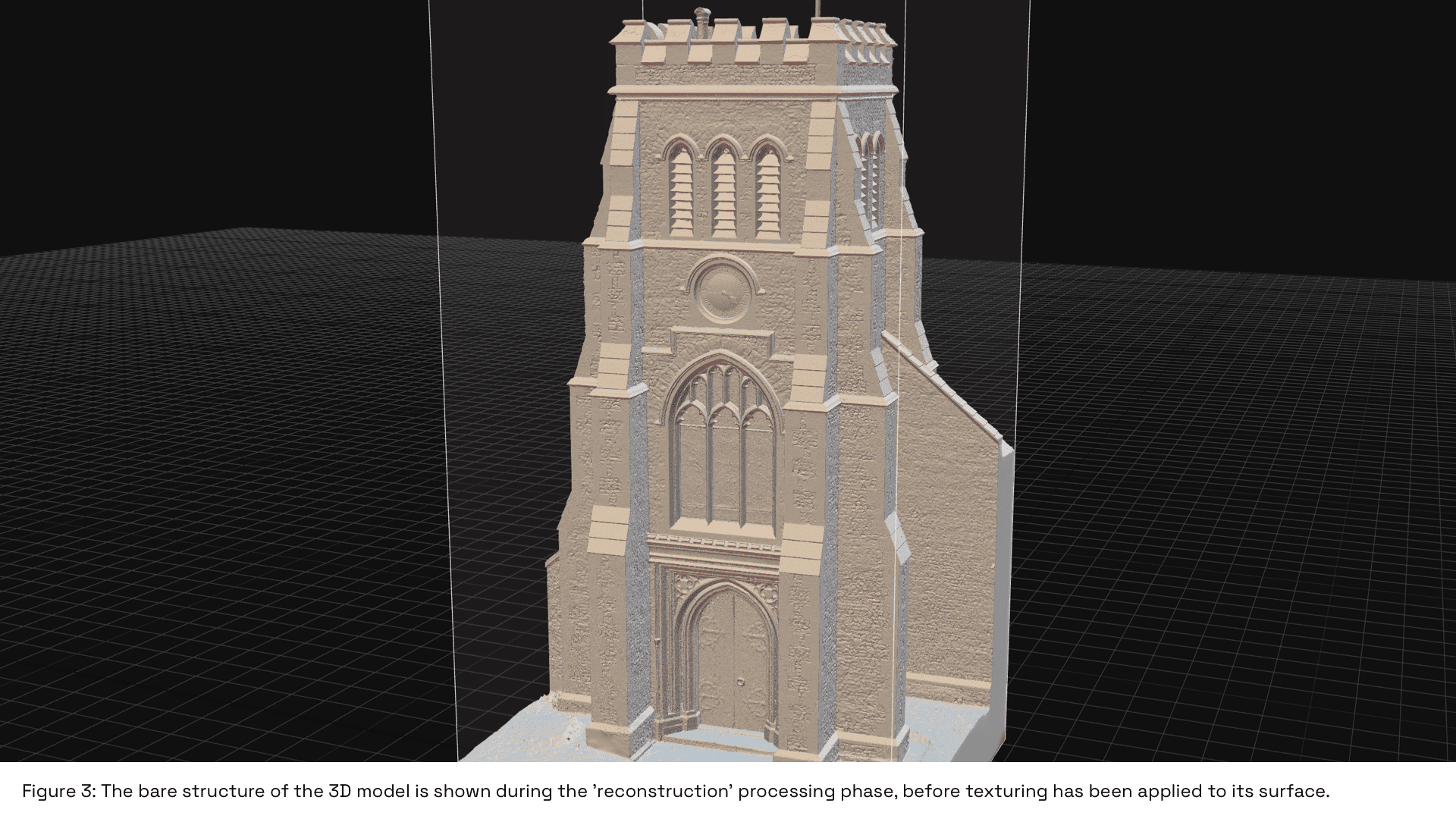
Texturing is the stage at which the photorealistic ‘cover’ is ‘stretched’ over the structural ‘skeleton’ of the model. The model’s texture can be affected by several factors, such as:
- distance from the camera to the target surface
- image blur due to unsuitable camera settings or movements
- large angles between the camera and building surface
- movement on the surface of the target (e.g. vegetation)
One of the main challenges was the potential for vastly different lighting conditions across the duration of the data capture. A similar effect can often be seen on satellite imagery, where blocks or strips of adjacent imagery have different colouring or show seasonal variations. Our intuitive knowledge of this process and its requirements enabled us to successfully mitigate for these effects in our processing of imagery.
Accuracy and Results
To test the absolute accuracy of the positions of features within our model, we laid several ground control points (GCPs) in the study area, pinpointing these with a survey-grade ground-based GNSS receiver.
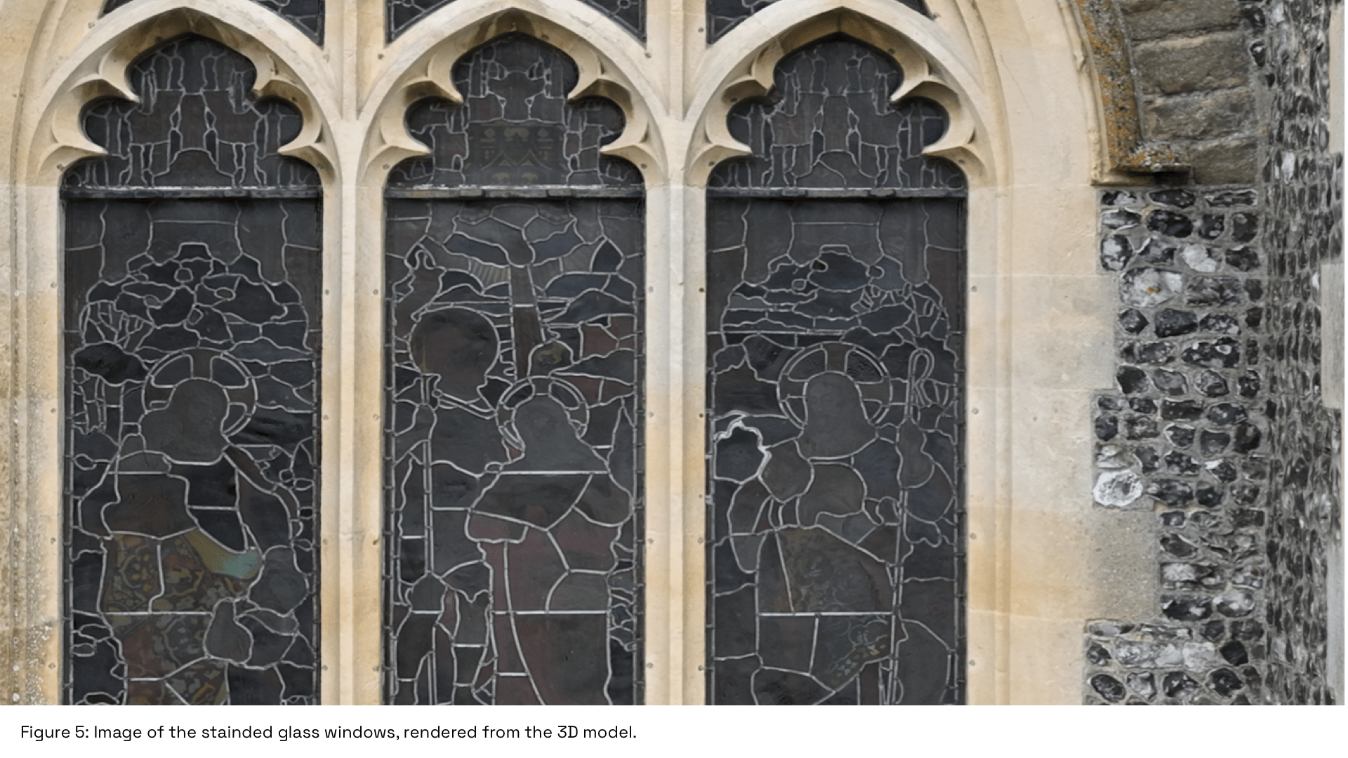
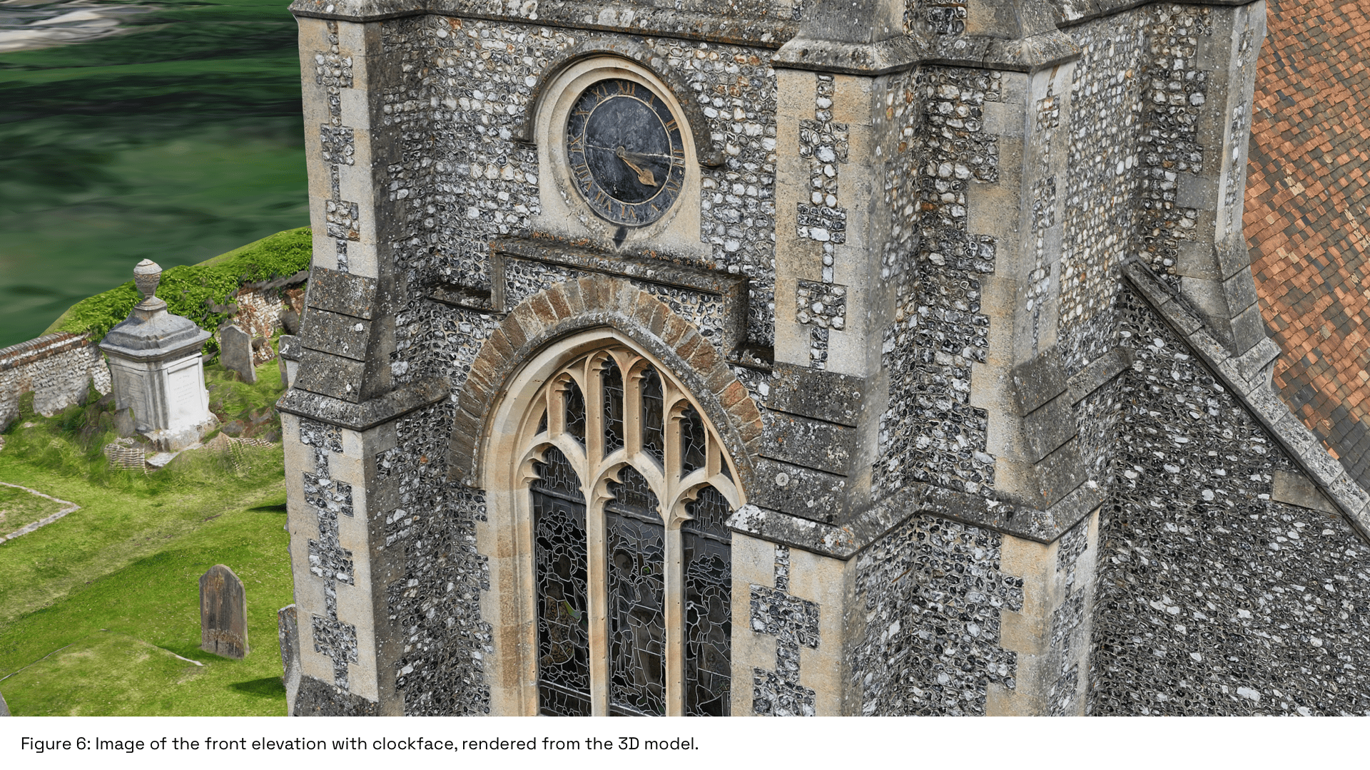
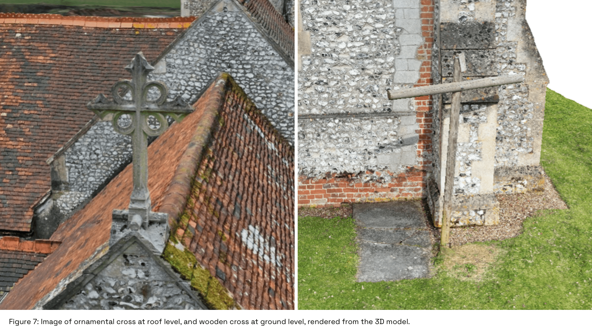
The relative accuracy, which concerns the accuracy of features in the model relative to each other, appears very high, as shown by the detail in the ornate building features such as stained-glass windows, clock face, and a mixture of free-standing crosses located on the site.
They provide excellent examples of the power of photogrammetric 3D modelling to recreate real-life objects via advanced UAV imaging and processing techniques.
Conclusion
The ultra-high-resolution 3D drone modelling of St Lawrence Church showcases the power of cutting-edge drone technology and geospatial software.
By meticulously pre-planning flights, using advanced imaging techniques, and employing industry-leading photogrammetry software, we believe that we succeeded in creating a highly detailed and accurate digital twin of the 12th Century church.
This project not only demonstrates our operational expertise but also highlights the broader benefits of transforming physical assets into digital representations for industry applications, including heritage preservation, building inspection, maintenance and planning.
Contact Us
At Survey Air, we offer specialist UAV modelling services tailored for industry applications, including products such as 3D building models, facade inspections, and topographical mapping.
If you are interested in using our UAV services for your next survey or project, please contact our expert team today to request a free quote and consultation.