What Is Scan-to-BIM? LiDAR Process, Benefits, and Applications
The Future of Scan-to-BIM in the UK
Scan-to-BIM is the first step in many BIM workflows, where physical environments are captured using advanced LiDAR technologies and converted into spatially accurate, data-rich models.
UAV, terrestrial, and handheld LiDAR sensors produce complementary datasets that are merged into unified point clouds before being modelled within BIM software. This creates a robust digital foundation, ensuring downstream processes are built on verified as-built data.
The resulting models provide a shared environment where project stakeholders can work from a single, intelligent representation of the asset, integrating architectural, structural, and services information with high accuracy.
Scan-to-BIM is transforming how the architecture, engineering, and construction (AEC) industries document and interact with physical assets.
In this post, we’ll explore how Scan-to-BIM works, how aerial, terrestrial, and handheld LiDAR data are combined, and its wider applications within the UK.
Understanding Scan-to-BIM
Building Information Modelling (BIM) is the process of creating and managing digital representations of physical assets, integrating geometry with data on materials, systems, and performance.
For BIM to deliver reliable outcomes, the workflow must begin with an accurate record of existing conditions. This is where Scan-to-BIM plays a critical role.
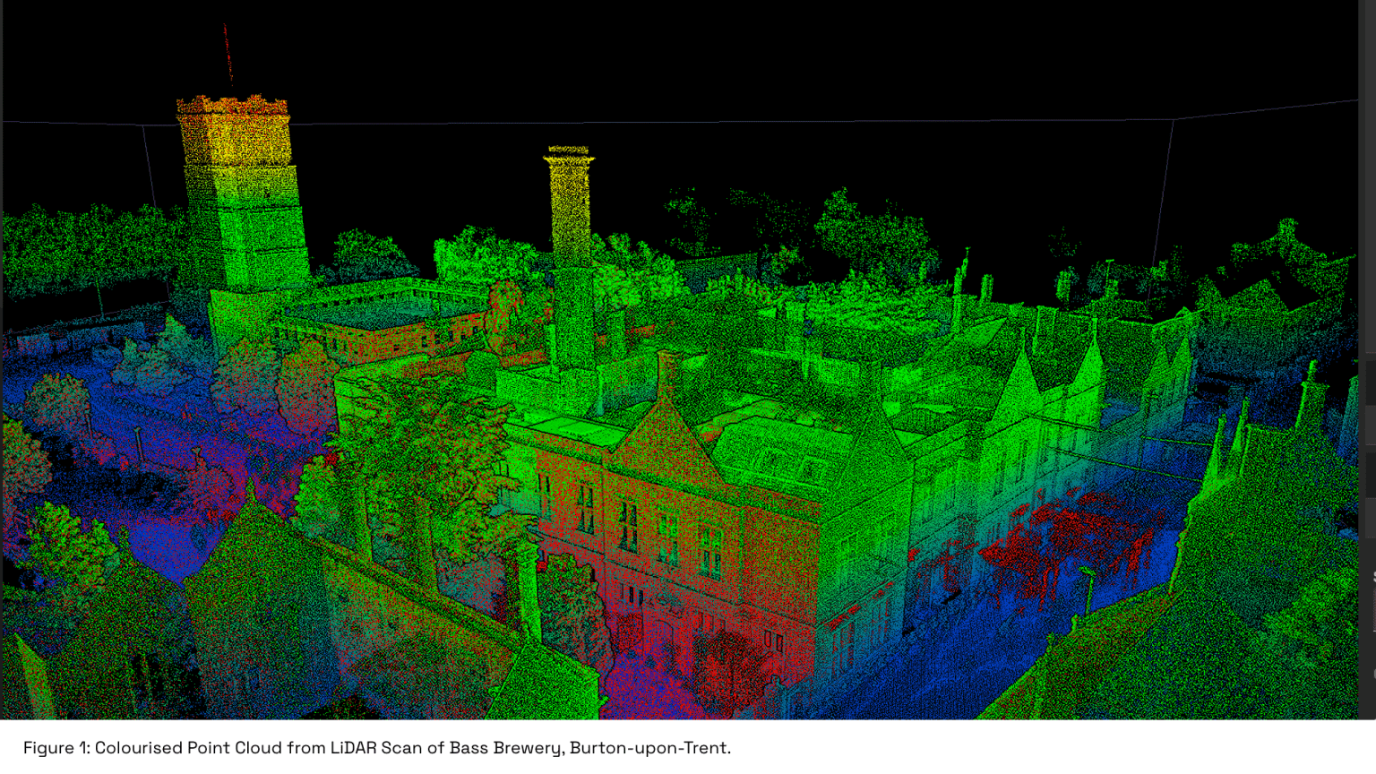
By capturing the physical environment with LiDAR technology, dense point clouds provide a spatially precise foundation for subsequent modelling. Without this step, BIM processes risk being built on assumptions or outdated drawings.
The Scan-to-BIM workflow typically involves three key stages: acquisition, processing, and modelling.
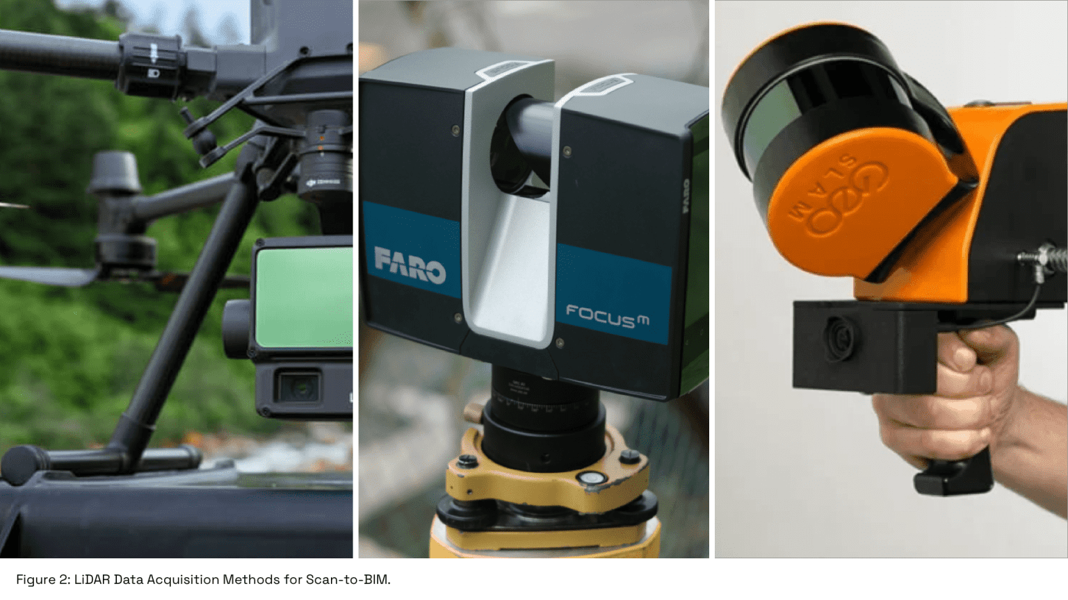
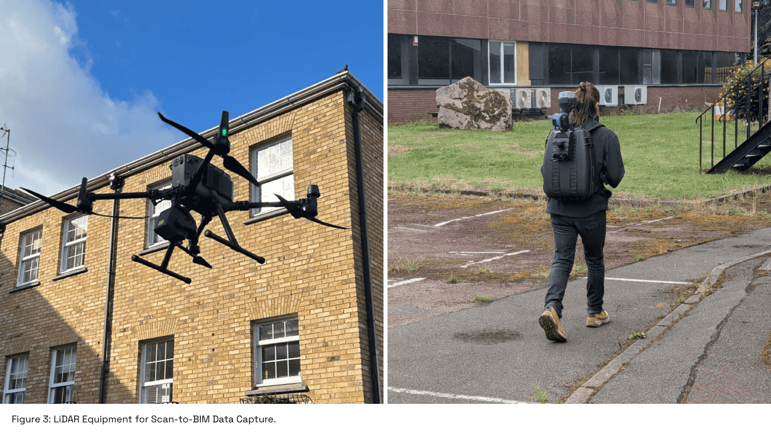
- Acquisition: LiDAR sensors, whether deployed via drone, tripod, or handheld device, capture millions of spatial measurements to form a raw point cloud. Factors such as scan resolution, point density, and georeferencing are determined at this stage to ensure the dataset meets the accuracy requirements for the intended BIM application.
- Processing: The raw point cloud is cleaned, filtered, and aligned to remove noise, duplicates, or artefacts. Registration aligns scans to a common coordinate system, ensuring spatial consistency across datasets. The processed point cloud forms a coherent and reliable digital representation of the as-built environment, ready for BIM integration.
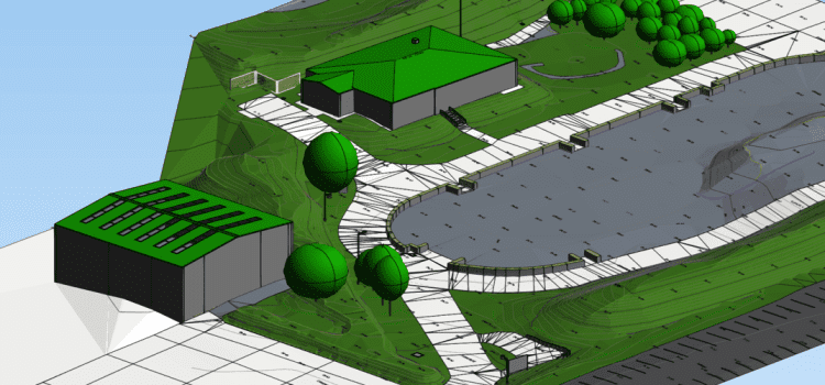
- Modelling: In the final stage, the processed point cloud is imported into BIM software and converted into an intelligent, structured model. Elements such as walls, floors, ceilings, windows, and doors are traced and parametrically defined, creating a digital twin of the asset. The outcome is a high-fidelity digital twin that accurately reflects the as-built environment and underpins all downstream BIM applications.
By following these three stages, Scan-to-BIM establishes the foundation for accurate and efficient BIM workflows, enabling AEC professionals to leverage high-fidelity as-built data from the outset of a project.
Integrating LiDAR Datasets
Producing a high-fidelity digital model for BIM requires the integration of LiDAR datasets captured from multiple sources, including UAVs, terrestrial scanners, and handheld devices.
Each capture method contributes valuable geometric and spatial information, forming a comprehensive representation of the built environment. By combining these captures, Scan-to-BIM workflows create a complete point cloud that serves as the backbone for subsequent modelling and analysis.
The integration process involves several critical stages. Initially, raw point cloud data is preprocessed to remove noise and irrelevant data points, ensuring a clean and accurate dataset. The individual scans are then aligned and geo-referenced to a common coordinate system, allowing data from different acquisition methods to be merged seamlessly.
Overlaps are reconciled and inconsistencies corrected through advanced registration and filtering. The result is a unified, coherent point cloud that accurately captures both macro-scale structures and finer architectural details.
Once integrated, the comprehensive point cloud can be imported into BIM software, where it is converted into an intelligent digital model. This model forms a shared data environment, enabling design coordination, clash detection, and detailed documentation of all physical elements.
By leveraging multiple LiDAR acquisition methods, Scan-to-BIM workflows ensure that BIM models are not only geometrically precise but also robust and reliable, providing a solid foundation for all downstream applications across the asset lifecycle.
Applications of Scan-to-BIM
Scan-to-BIM has rapidly become an essential tool across the architecture, engineering, and construction (AEC) industries, providing accurate as-built data that underpins a wide range of applications.
By converting LiDAR-acquired point clouds into intelligent digital models, professionals can interact with highly detailed representations of existing assets, enabling more informed decision-making throughout the asset lifecycle.
In design and planning, Scan-to-BIM allows architects and engineers to verify existing conditions, detect potential clashes, and evaluate design options with precision. Contractors can leverage accurate models to improve construction sequencing, reduce rework, and streamline coordination between trades.
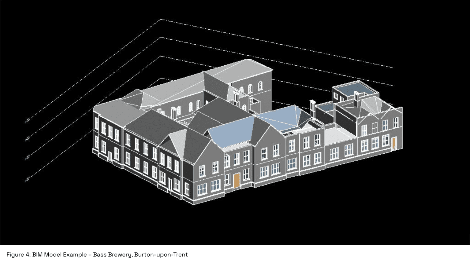
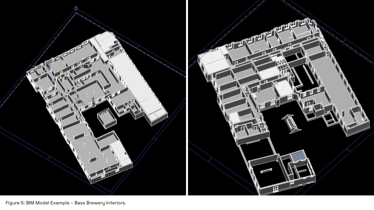
Facilities managers and building owners benefit from up-to-date digital twins, which support maintenance planning, space management, and operational efficiency over the long term. In one UK heritage project, Scan-to-BIM enabled accurate conservation planning by capturing fine interior details alongside external elevations.
The integration of multiple LiDAR datasets ensures that both external and internal features are captured comprehensively, providing complete context for structural assessments, retrofitting projects, and heritage or conservation initiatives.
In the UK, Scan-to-BIM is increasingly used in large-scale infrastructure, commercial development, and historic building projects, delivering measurable improvements in accuracy, efficiency, and risk reduction compared to traditional surveying methods.
By establishing a robust, data-rich foundation, Scan-to-BIM transforms how stakeholders document, analyse, and manage assets, bridging the gap between physical reality and digital workflows and enabling the full potential of BIM to be realised.
Conclusion
Scan-to-BIM represents a critical step in the UK for modern BIM workflows, providing the accurate, data-rich foundation required to model, analyse, and manage the built environment.
By integrating LiDAR datasets from UAVs, terrestrial scanners, and handheld devices into unified point clouds, Scan-to-BIM enables the creation of precise digital models that reflect both geometric and functional characteristics of existing built assets.
Whether for complex infrastructure, commercial developments, or heritage buildings, the ability to generate reliable digital twins from as-built conditions ensures that projects are executed with greater confidence, reduced risk, and enhanced operational insight.
As Scan-to-BIM continues to evolve, its integration into broader BIM processes is becoming standard practice, ensuring compliance with industry standards while improving project delivery outcomes.
If you’re exploring Scan-to-BIM for your next project, get in touch with Survey Air to discuss how UAV and LiDAR technologies can support accurate and efficient project delivery.