Structured UAV Inspection Data for Complex & Large-Scale Assets
When conducting UAV inspections of large or complex assets, data capture represents only the initial stage of the survey process. The primary technical challenge lies in ensuring that the resulting dataset is structured in a way that enables efficient interpretation, spatial traceability, and reliable use by surveyors, engineers, and asset managers.
At scale, this becomes increasingly critical. Repetitive architectural features, uniform building elements, and extensive multi-unit developments introduce inherent ambiguity when imagery is not systematically indexed. Without a defined structured methodology, even a technically complete UAV survey can become operationally inefficient in practice.
At Survey Air, data structure is treated as a core component of survey design rather than a post-processing exercise. Prior to deployment, a structured referencing framework is defined to govern how the asset is segmented, how features are identified, and how the final dataset is indexed for downstream use. The result is a geospatially coherent inspection dataset designed for professional interpretation without reliance on additional contextual explanation.
This article sets out the principles and methodology behind structured UAV inspection data for complex and large-scale assets. The key objectives are:
- Establishing structured UAV survey design methodologies: How asset-specific referencing frameworks are defined prior to data capture.
- Improving interpretability of large-scale inspection datasets: How hierarchical indexing and structured naming conventions enable retrieval and analysis.
- Supporting professional surveying and engineering workflows: How structured UAV inspection outputs are delivered in a format aligned with RICS-informed expectations for traceability and clarity.
Complex Asset Inspection at Scale
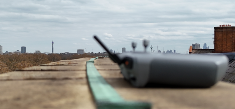
A UAV inspection of a complex structure or large estate can generate thousands of individual images. In many cases, a significant proportion of these will be visually similar without spatial context or structured referencing.

High-resolution UAV imagery capturing intricate mosaic detailing and façade elements at the Royal Albert Hall.
At the Royal Albert Hall, a structurally intricate landmark defined by continuous curved façades, repetitive architectural detailing, and ornate elevation elements, the requirement for precise spatial referencing was fundamental. Without a structured indexing system, individual inspection images would lack positional clarity within the broader dataset, limiting their utility for engineering review and condition assessment.

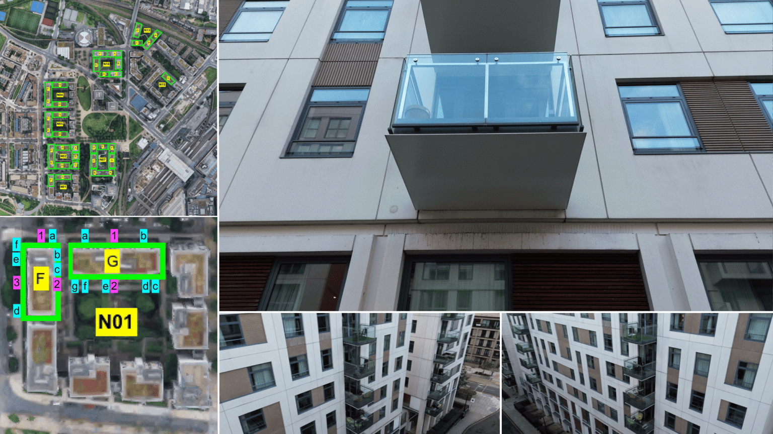
Aerial overview of East Village in Stratford, where over 1,200 residential balconies were inspected and catalogued.
At East Village in Stratford, the challenge was defined by scale and uniformity. Over 1,200 residential balconies required systematic inspection across multiple plots. In such environments, where units are intentionally identical by design, reliable asset management depends entirely on accurate spatial referencing and consistent data structure.
Although the asset types differ, the underlying requirement remains consistent; a structured UAV inspection dataset that enables any competent professional to locate, interpret, and verify information without additional site context.
Survey Structuring and Capture Methodology
The structuring process begins prior to UAV deployment. Each project is initiated with a detailed review of available architectural drawings, site plans, and supporting documentation to establish a comprehensive understanding of the asset.
From this, a site-specific UAV inspection framework is defined, including:
- Spatial segmentation of the asset into logical inspection zones
- Standardised naming conventions for all captured imagery
- Hierarchical indexing rules for dataset organisation and retrieval
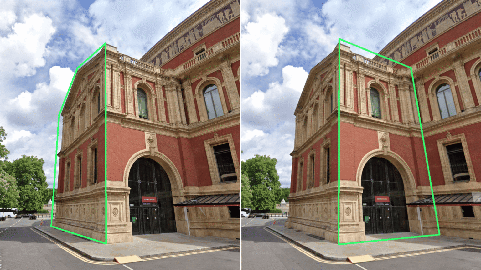
Example of how architectural elements were divided into inspection zones to support spatial referencing and structured data delivery.
Flight planning is then aligned directly with this framework to ensure complete and systematic coverage of the asset. This ensures that spatial consistency is maintained from capture through to delivery.
Following data acquisition, each image is individually reviewed and assigned a structured identifier. Rather than relying on generic file naming conventions, each record describes its precise spatial context, including zone, elevation, façade element, or unit reference.

Comparison of balcony and soffit types across East Village, highlighting the importance of structured image cataloguing.
For large-scale assets such as East Village, this results in over 1,000 uniquely referenced inspection images. For complex structures such as the Royal Albert Hall, it ensures that each inspection record is directly traceable to a defined architectural location.
Data Referencing and Delivery
At the Royal Albert Hall, the asset was divided into quadrants and twelve structured inspection zones reflecting its architectural composition. These included principal façades, annex structures, balcony levels, and dome elements.
Each zone was further subdivided using a hierarchical referencing system aligned with architectural geometry. This enabled accurate spatial traceability for every captured image, ensuring that each record could be located and interpreted within its exact structural context.
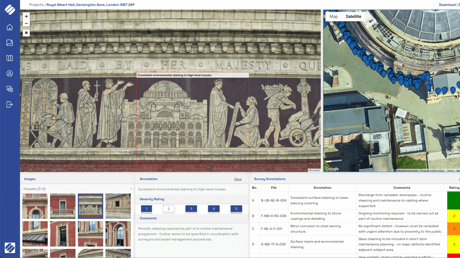
Inspection imagery delivered through the Survey Air portal, enabling spatial navigation, annotation, and categorisation of survey findings.
At East Village, a different structuring logic was required. The estate layout formed the basis of the referencing system, using a five-tier hierarchy: Plot. Block, Façade, Column, and Level.
An example reference of N01-F-1-a-3 provides a complete spatial descriptor , identifying:
- The plot
- The block and façade
- The balcony column
- The floor level
Master and block site plans used alongside structured image sets to enable rapid retrieval of individual balcony inspection records.
Master and block site plans used alongside structured image sets to enable rapid retrieval of individual balcony inspection records.
This structure ensures that any individual asset element, further supported by marked drawings and annotated site plans, can be located instantly within a dataset comprising over 1,200 inspection points.
Across both projects, the principle remains consistent: referencing systems are defined by the asset, not imposed upon it. This ensures that each UAV inspection dataset reflects the physical and operational logic of the structure being surveyed.
Conclusion
A UAV inspection is only as valuable as the structure of the data supporting it. For complex and large-scale assets, data structuring must be embedded within survey design methodology, rather than applied retrospectively.
Whether applied to a landmark heritage structure or a multi-plot residential estate, the outcome remains the same; a structured UAV inspection dataset that is traceable, interpretable, and suitable for use by surveyors, engineers, and asset managers without full reliance on site context.
If you have a complex asset requiring structured UAV inspection or geospatial data capture, please contact the Survey Air team to discuss your requirements: https://surveyair.co.uk/contact