
UAV Mapping for Construction, Civil Engineering & Land Management
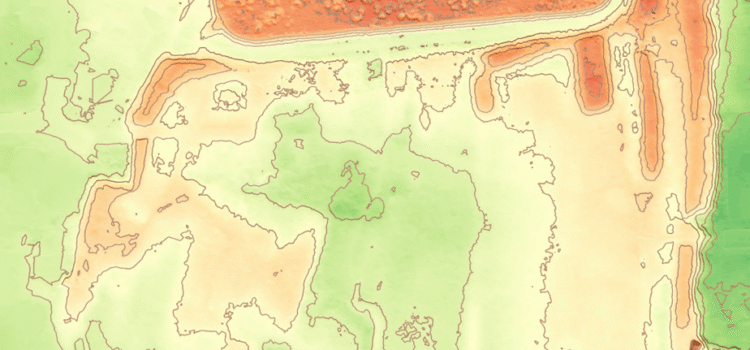
Topographic survey data has become a critical input across construction, civil engineering, and land management projects. A single UAV topographic survey can produce a structured suite of georeferenced outputs, including terrain models, surface models, contour data, and orthophotos, delivered in formats compatible with standard CAD and GIS workflows.
However, the value of this information is not defined by data capture alone. It is defined by how effectively it can be interpreted and applied within live project environments.
A UAV survey does not produce a single output. It produces a coherent geospatial dataset, typically comprising a Digital Terrain Model (DTM), Digital Surface Model (DSM), and a georeferenced orthophoto. Each dataset serves a distinct purpose, but together they form a consistent and measurable representation of site conditions prior to construction or development activity.
This article explains how UAV topographic survey data is used in practical project environments and why structured geospatial information is increasingly central to modern construction delivery, including:
- How UAV topographic survey outputs are structured for engineering and construction workflows
- How terrain and surface models inform design, earthworks, and infrastructure planning
- How geospatial datasets reduce uncertainty and improve coordination across multidisciplinary teams
Core Outputs of UAV Topographic Survey Data
A UAV topographic survey produces multiple layers of geospatial information derived from a single capture process, each contributing to a different stage of analysis and design.
The Digital Surface Model (DSM) represents all visible features within the survey area, including terrain, vegetation, and built structures. The Digital Terrain Model (DTM) removes above-ground features to represent bare-earth conditions.
In construction and civil engineering applications, the DTM is typically the primary dataset. It underpins earthworks modelling, drainage design, flood risk assessment, and cut and fill calculations.
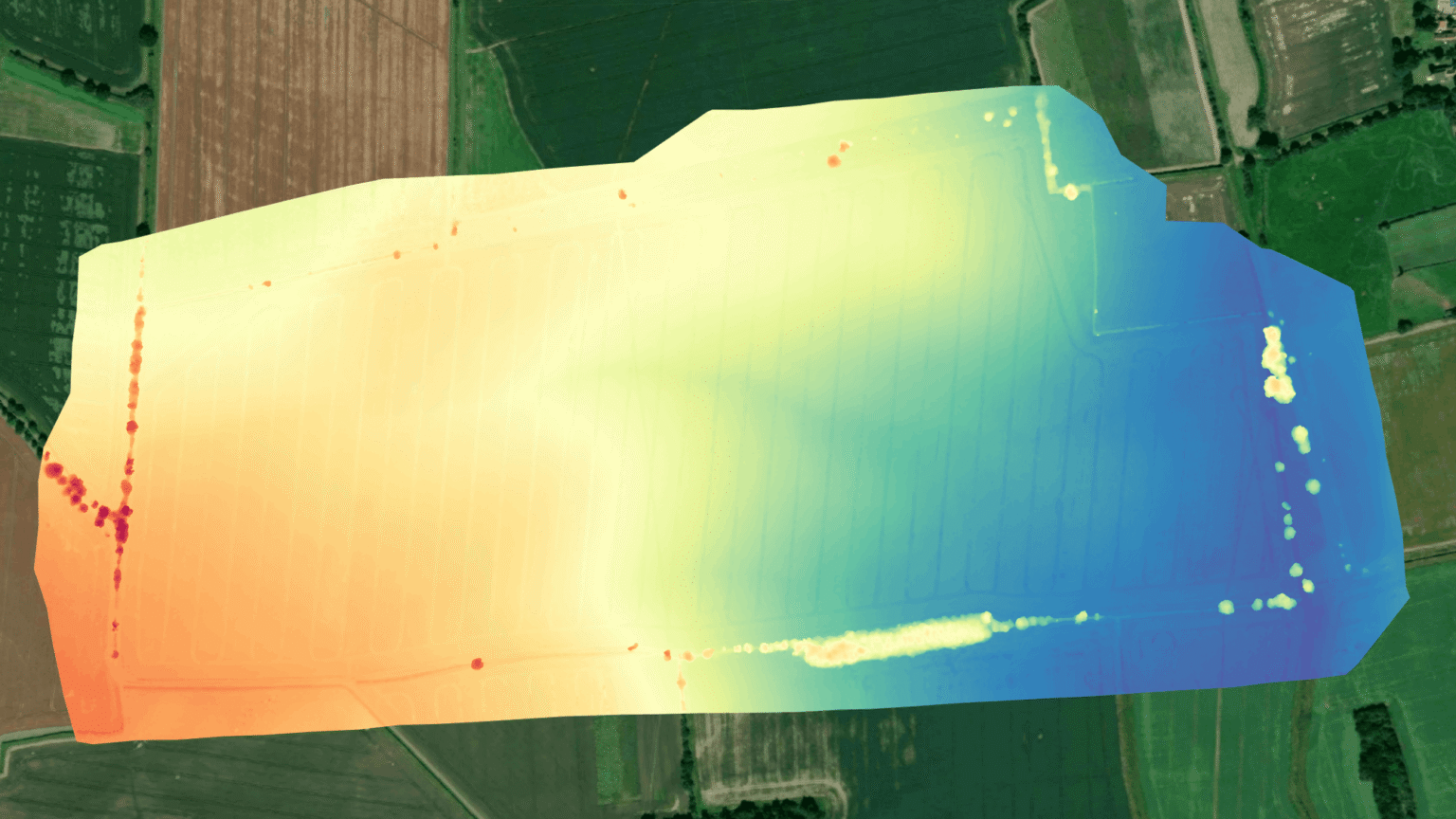
Digital Surface Model (DSM) capturing terrain, vegetation, and surface features identified during UAV data processing.
When scaled across large sites, even small variations in elevation data can materially affect material movement strategies, programme sequencing, and cost exposure. As a result, reliable terrain modelling is critical at early project stages.
Contours are derived directly from the DTM and delivered as CAD-ready outputs at project-specific intervals, allowing direct integration into design workflows.
The orthophoto provides a georeferenced, true-scale visual layer of the site. Unlike standard aerial imagery, it is geometrically corrected to remove distortion and displacement, enabling it to function as a measurable base map within CAD and GIS environments.
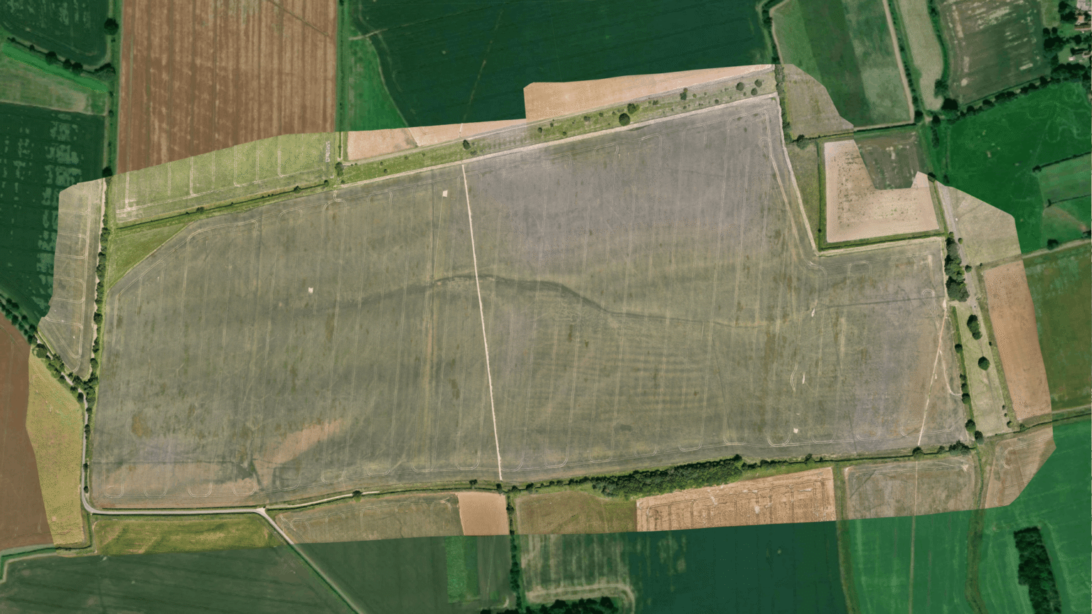
High-resolution RGB orthomosaic providing a true-scale, georeferenced visual representation of site conditions.
Where multispectral data is captured, additional spectral bands such as near-infrared and red edge can extend the dataset to support vegetation analysis, moisture variation mapping, and broader land classification applications.
UAV Topographic Survey Data in Project Delivery
The value of UAV topographic survey data becomes most apparent when it is applied within live project environments rather than treated as a static deliverable.
In construction and civil engineering workflows, topographic data is required at the earliest stages of project development. Accurate terrain models allow design teams to move from assumption-based planning to evidence-led design, reducing uncertainty before groundworks commence.
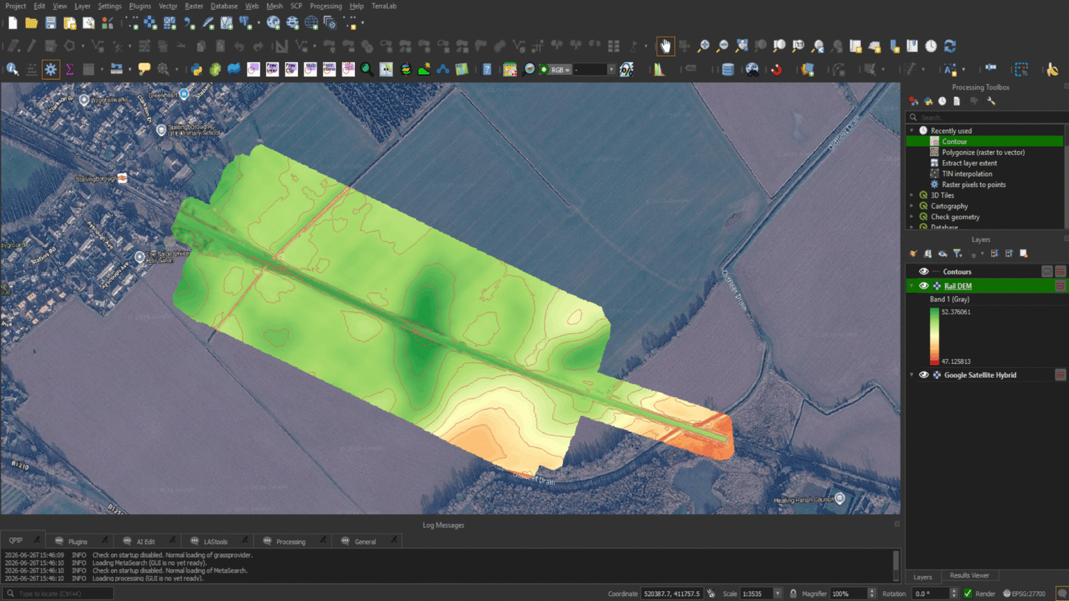
UAV-derived Digital Terrain Model with contour generation supporting engineering analysis and infrastructure design.
In drainage and infrastructure design, continuous surface modelling provides engineers with a clearer understanding of slope behaviour and overland flow paths. These insights are often difficult to achieve using fragmented or legacy survey data alone and allow for more informed design decisions at concept stage.
Cut and fill analysis, derived from UAV-based DTM data, is central to understanding material movement across a site. Reliable elevation modelling enables early optimisation of earthworks strategies, reducing unnecessary haulage, rework, and associated programme inefficiencies.
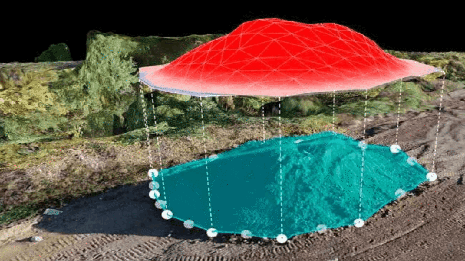
Cut and fill analysis derived from UAV survey data, enabling accurate stockpile volume calculations and material management.
In land management and planning applications, UAV topographic survey data supports feasibility studies, boundary interpretation, rights of light analysis, heritage assessments, and agricultural land classification.
Where repeat surveys are undertaken, datasets also provide a longitudinal record of site change, supporting erosion monitoring, progress tracking, and planning compliance verification across larger or phased developments.
How UAV Survey Data Improves Project Decision-Making
The primary value of UAV topographic survey data lies in its ability to improve the quality and timing of project decisions.
Rather than relying on incomplete or outdated site information, project teams can work from a georeferenced dataset that reflects current site conditions at the point of capture.
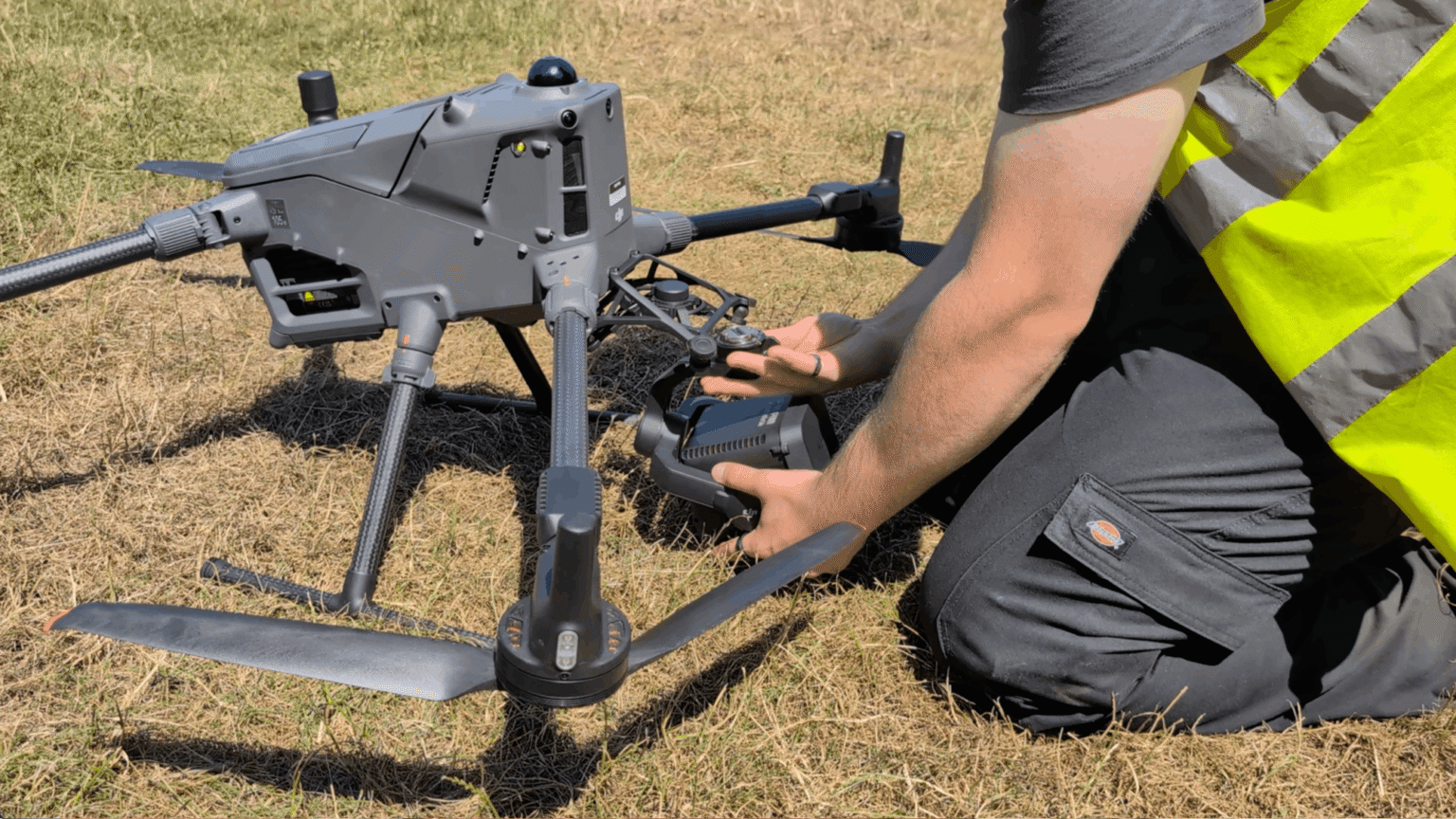
DJI Matrice platform equipped with LiDAR technology for high-accuracy topographic data capture in the field.
This reduces uncertainty in early-stage design, improves coordination across disciplines, and limits the risk of misalignment between design intent and physical site reality.
In practical terms, UAV-derived terrain models allow constraints to be identified earlier, design assumptions to be tested more reliably, and decisions to be made with greater spatial confidence.
As a result, the survey output becomes more than a record of existing conditions. It becomes a decision-support dataset embedded within the project workflow.
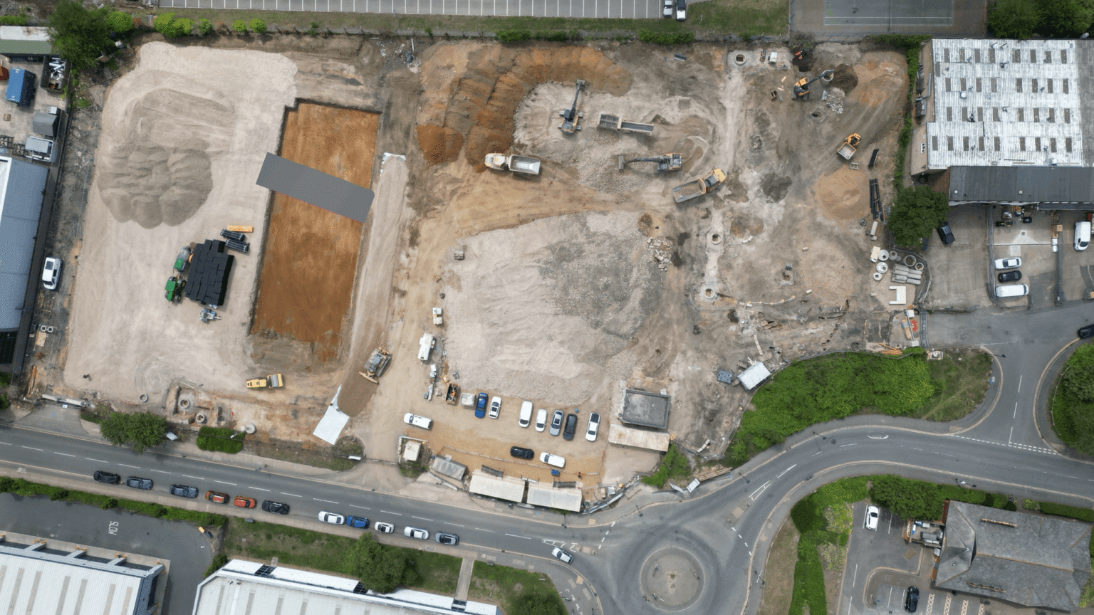
Aerial mapping imagery captured during early-stage brownfield redevelopment, providing a spatial baseline for construction planning.
Conclusion
As construction and infrastructure projects become increasingly data-driven, the importance of accurate and structured geospatial information continues to grow.
A UAV topographic survey provides a scalable method for delivering this information, combining terrain modelling, surface data, and orthophotos into a single, integrated dataset suitable for engineering, design, and planning applications.
When delivered effectively, UAV topographic survey data reduces uncertainty, improves coordination, and supports more informed decision-making across construction, civil engineering, and land management projects.
At Survey Air, we focus on ensuring that UAV survey outputs are not only technically accurate, but operationally meaningful — enabling engineers, surveyors, and contractors to move from capture to confident decision-making without ambiguity.
If you are planning a project requiring UAV topographic survey data, contact the Survey Air team to discuss your requirements: https://surveyair.co.uk/contact